


Garmin G1000 Pilot’s Guide for the Diamond DA42NG
190-00962-02 Rev. A
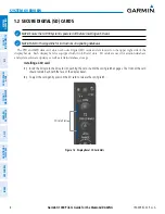
22
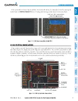
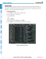
SYSTEM OVERVIEW
SY
STEM
O
VER
VIEW
FLIGHT
INSTRUMENTS
EIS
AUDIO P
ANEL
& CNS
FLIGHT
MANA
GEMENT
HAZARD
AV
OID
ANCE
AFCS
ADDITIONAL FEA
TURES
APPENDICES
INDEX
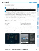
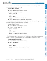
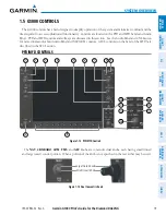
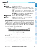
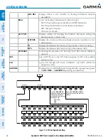
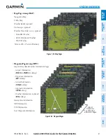
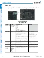
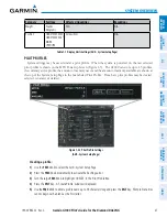
Figure 1-16 Top Level PFD Softkeys
INSET
XPDR
IDENT
TMR/REF NRST
ALERTS
OBS
PFD
CDI
ADF/DME
(optional)
Press the
CDI
Softkey to cycle through
navigation sources:
- GPS
- NAV1 (VOR/LOC)
- NAV2 (VOR/LOC)
BACK
Press the
OFF
or
BACK
Softkey
to return to the top-level softkeys.
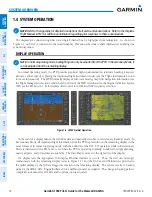
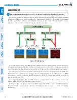
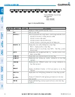
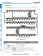
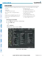
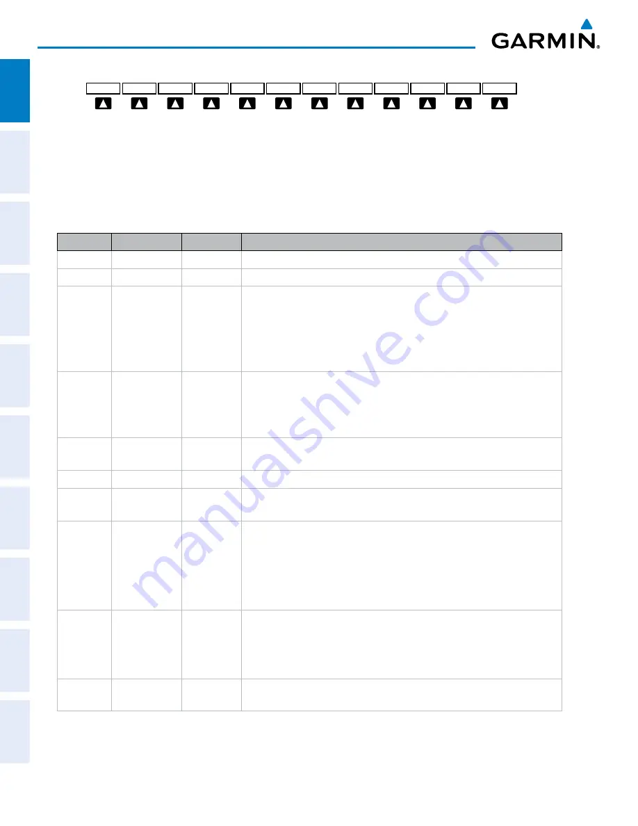
DCLTR
DCLTR-2
DCLTR-3
DCLTR-1
TOPO
ALERTS
NEXRAD
(optional)
TERRAIN
XM LTNG
(optional)
OFF
TRAFFIC
INSET
STRMSCP
(optional)
TRFC-2
TRFC-1
METAR
(optional)
or
PRECIP
or
DL LTNG
Level 1
Level 2
Level 3
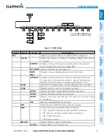
Description
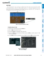
INSET
Displays Inset Map in PFD lower left corner
OFF
Removes Inset Map
DCLTR (3)
Selects desired amount of map detail; cycles through declutter levels:
DCLTR (No Declutter): All map features visible
DCLTR-1: Removes land data
DCLTR-2: Removes land and SUA data
DCLTR-3: Removes everything except active flight plan
TRAFFIC (2)
Displays/removes traffic information on Inset Map
TRFC-1: Displays traffic on Inset Map.
TRFC-2: Removes everything except traffic. Inset Map position
HDG UP only.
TOPO
Displays/removes topographical data (e.g., coastlines, terrain, rivers,
lakes) on Inset Map
TERRAIN
Displays/removes terrain information on Inset Map
STRMSCP
Displays/removes Stormscope weather information on Inset Map
(
optional
)
NEXRAD
or
PRECIP
Displays/removes NEXRAD weather and coverage information on
Inset Map (
optional
)
Displays Worldwide Weather or FIS-B precipitation on the Map
(
optional
)
XM LTNG
or
DL LTNG
Displays/removes XM lightning information on Inset Map (
optional
)
Displays Worldwide Weather lightning information on the Inset
Map
(
optional
)
METAR
Displays METAR flags on airport symbols shown on the Inset Map
(
optional
)