


190-00962-02 Rev. A
Garmin G1000 Pilot’s Guide for the Diamond DA42NG
355
HAZARD AVOIDANCE
SY
STEM
O
VER
VIEW
FLIGHT
INSTRUMENTS
EIS
AUDIO P
ANEL
& CNS
FLIGHT
MANA
GEMENT
HAZARD
AV
OID
ANCE
AFCS
ADDITIONAL
FEA
TURES
APPENDICES
INDEX
METARS AND TAFS
NOTE:
Atmospheric pressure is reported in inches of mercury (in Hg). Temperatures are reported in Celsius.
NOTE:
The system will begin to display METAR flags as it receives reports; however it may take approximately
ten minutes for all available METAR and TAF data to be received over a FIS-B broadcast.
Aviation Routine Weather Reports or METARs typically contain current information about the temperature,
dewpoint, wind, precipitation, cloud cover, cloud heights, visibility, and barometric pressure at an airport or
observation station. They can also contain information on precipitation amounts, lightning, and other critical
data. METARs reflect routine hourly observations. An Aviation Selected Special Report or SPECI includes
the code “SPECI” in the report, and may be issued if critical information has changed after the issuance of a
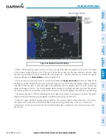
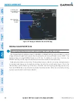
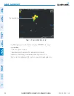
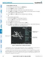
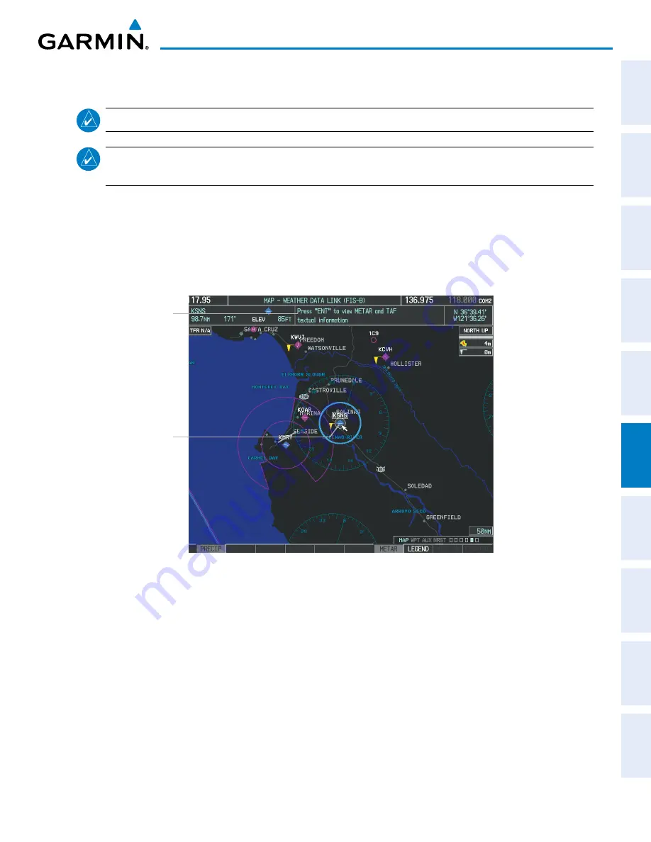
METAR. The system displays colored flags at airports with report(s) available.
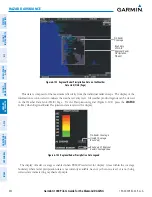
Figure 6-106 METAR Flags on the Weather Data Link Page
Instructions for
Viewing METAR
and TAF Text
Selected Airport
TAFs (Terminal Aerodrome Forecasts) are predications of expected weather conditions for an area within
five statute miles of the center of an airport’s runway complex. The National Weather Service issues scheduled
TAFs four times each day, and additional amended TAFs if conditions warrant. TAFs typically span a forecast
period of 24 hours, but may be scheduled for a longer period. TAFs may include forecast wind, visibility,
significant weather phenomena, and sky conditions using METAR codes.
METAR and TAF text are available on the Weather Information Page. METAR data is displayed first in a
decoded fashion, then as raw text. TAF information, when available, appears only as raw text.