190-00962-02 Rev. A
Garmin G1000 Pilot’s Guide for the Diamond DA42NG
23
SYSTEM OVERVIEW
SY
STEM
O
VER
VIEW
FLIGHT
INSTRUMENTS
EIS
AUDIO P
ANEL
& CNS
FLIGHT
MANA
GEMENT
HAZARD
AV
OID
ANCE
AFCS
ADDITIONAL
FEA
TURES
APPENDICES
INDEX
INSET
XPDR
IDENT
TMR/REF NRST
ALERTS
OBS
PFD
CDI
ADF/DME
(optional)
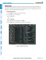
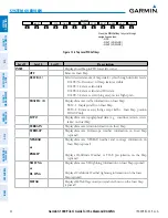
Press the
CDI
Softkey to cycle through
navigation sources:
- GPS
- NAV1 (VOR/LOC)
- NAV2 (VOR/LOC)
BACK
Press the
OFF
or
BACK
Softkey
to return to the top-level softkeys.
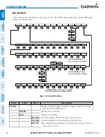
DCLTR
DCLTR-2
DCLTR-3
DCLTR-1
TOPO
ALERTS
NEXRAD
(optional)
TERRAIN
XM LTNG
(optional)
OFF
TRAFFIC
INSET
STRMSCP
(optional)
TRFC-2
TRFC-1
METAR
(optional)
or
PRECIP
or
DL LTNG
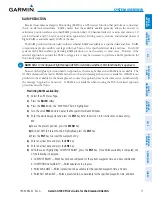
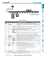
Figure 1-17 INSET Softkeys
Level 1
Level 2
Level 3
Description
PFD
Displays second-level softkeys for additional PFD configuration
SYN VIS
Displays the softkeys for enabling or disabling Synthetic Vision features
(
optional
)
PATHWAY
Displays rectangular boxes representing the horizontal and
vertical flight path of the active flight plan
SYN TERR
Enables synthetic terrain depiction
HRZN
HDG
Displays compass heading along the Zero-Pitch line
APTSIGNS
Displays position markers for airports within approximately
15 nm of the current aircraft position. Airport identifiers are
displayed when the airport is within approximately 9 nm.
DFLTS
Resets PFD to default settings, including changing units to standard
WIND
Displays softkeys to select and configure wind data
OPTN1
Displays wind data in longitudinal and lateral components
OPTN2
Displays wind data total direction and speed
OPTN3
Displays wind data total direction with head and cross-wind speed
components
OFF
Removes wind information from display
DME
Displays/removes DME Information Window (
optional
)
BRG1
Cycles the Bearing 1 Information Window through:
NAV1: Waypoint frequency/identifier and DME information
GPS: Waypoint identifier and GPS distance information
ADF: Waypoint frequency
Off: Removes window
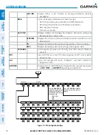
HSI FMT
Displays softkeys to select the HSI format
360 HSI
Displays HSI as a 360° compass rose

