


190-00962-02 Rev. A
Garmin G1000 Pilot’s Guide for the Diamond DA42NG
423
HAZARD AVOIDANCE
SY
STEM
O
VER
VIEW
FLIGHT
INSTRUMENTS
EIS
AUDIO P
ANEL
& CNS
FLIGHT
MANA
GEMENT
HAZARD
AV
OID
ANCE
AFCS
ADDITIONAL
FEA
TURES
APPENDICES
INDEX
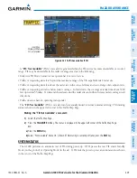
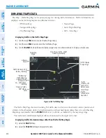
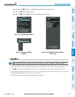
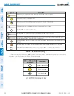
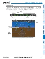
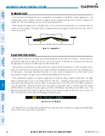
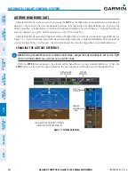
Aircraft
Identification
(tail number
or Flight ID
number)
Figure 6-172 Example Traffic Advisory with
Directional Information
Intruder
Aircraft
Ground Track
Relative Altitude
(in this case 1200
feet above own
aircraft)
Altitude Trend
(up arrow
indicates
climbing, down
arrow indicates
descending)
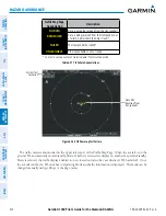
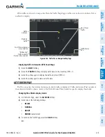
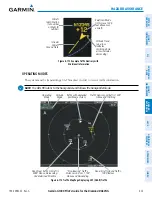
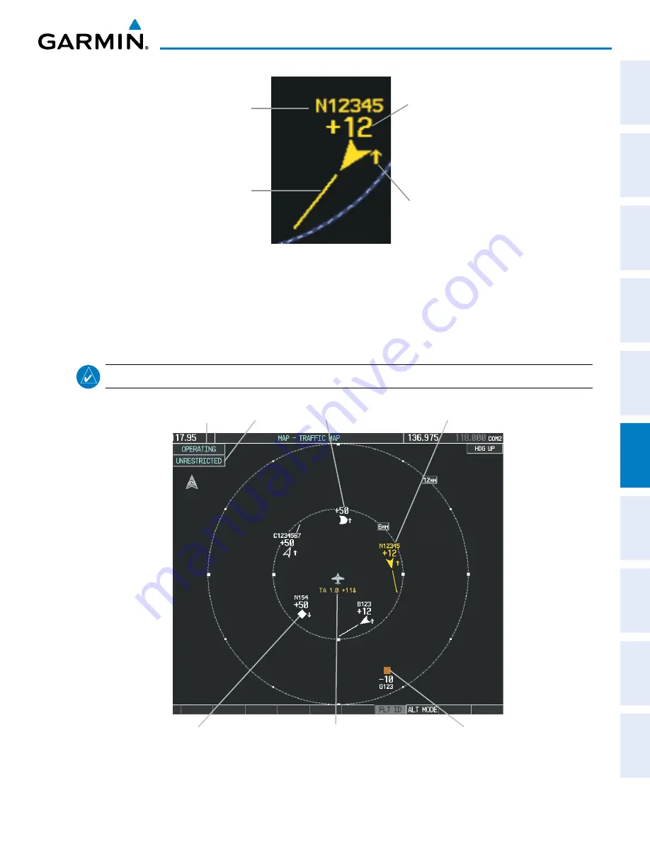
OPERATING MODES
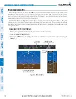
The system must be transmitting a UAT broadcast in order to receive traffic information.
NOTE:
The GDL 90 listens to the transponder and follows the transponder mode.
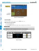
Figure 6-173 Traffic Map Page Displaying UAT (ADS-B) Traffic
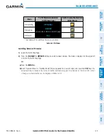
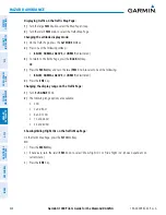
Operating
Mode
Altitude
Mode
Traffic Advisory, Aircraft is 1200’
Above and Climbing
“Non-Bearing” Traffic,
Distance is 8.0 nm, 1100’
Above and Descending
Non-Aircraft Ground Traffic,
1000’ Below
Traffic with degraded
positional accuracy
Non-threat traffic, Aircraft is
5000’ Above, Descending,
Undetermined Direction