


Garmin G1000H
™
Pilot’s Guide for the Bell 407GX
190-01255-00 Rev. A
290
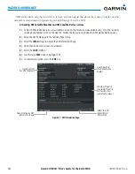
HAZARD AVOIDANCE
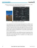
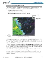
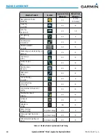
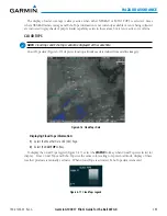
NEXRAD
NOTE:
NEXRAD data cannot be displayed at the same time as turbulence, icing, or terrain.
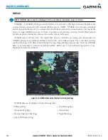
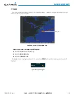
WSR-88D, or NEXRAD (NEXt-generation RADar), is a network of 158 high-resolution Doppler radar
systems that are operated by the National Weather Service (NWS). NEXRAD data provides centralized
meteorological information for the continental United States and selected overseas locations. The maximum
range of a single NEXRAD radar site is 250 nm. In addition to a wide array of services, the NEXRAD network
provides important information about severe weather and air traffic safety.
NEXRAD data is not real-time. The lapsed time between collection, processing, and dissemination of
NEXRAD images can be significant and may not reflect the current radar synopsis. Due to the inherent delays
and the relative age of the data, it should be used for long-range planning purposes only. Never use NEXRAD
data or any radar data to penetrate hazardous weather. Rather, use it in an early-warning capacity of pre-
departure and enroute evaluation.
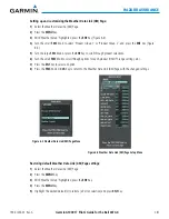
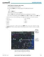
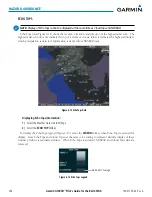
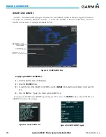
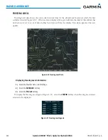
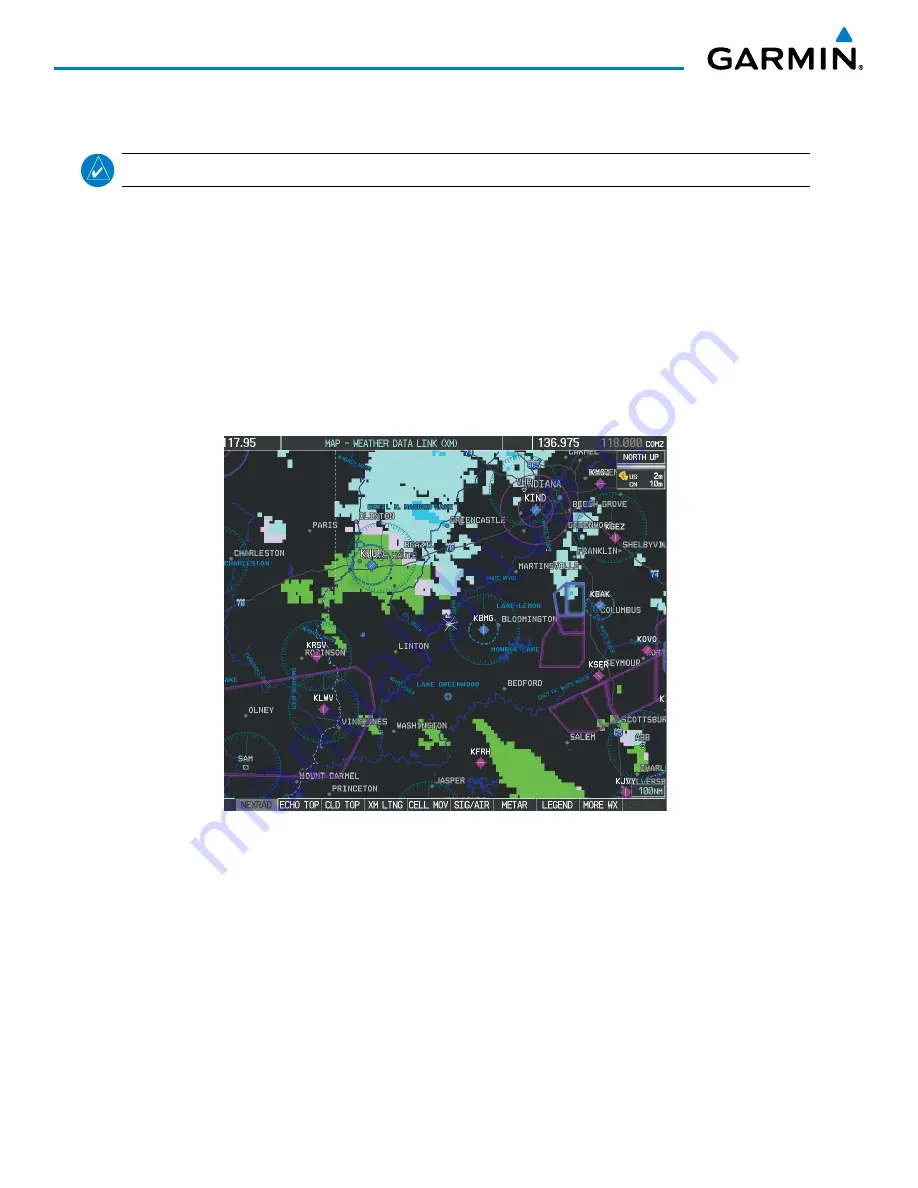
Figure 6-10 NEXRAD Data on the Weather Data Link (XM) Page
NEXRAD data can be displayed on the following maps:
• PFD Inset Map
• Navigation Map Page
• Weather Data Link (XM) Page
• Airport Information Page
• Trip Planning Page
• Nearest Pages
• Flight Plan Pages
Summary of Contents for G1000H
Page 1: ...G1000H Integrated Flight Deck Pilot s Guide Bell 407GX ...
Page 2: ......
Page 146: ...190 01255 00 Rev A Garmin G1000H Pilot s Guide for the Bell 407GX 134 AUDIO PANEL AND CNS ...
Page 518: ...190 01255 00 Rev A Garmin G1000H Pilot s Guide for the Bell 407GX 506 APPENDIX B Blank Page ...
Page 540: ...Garmin G1000H Pilot s Guide for the Bell 407GX 190 01255 00 Rev A I 6 INDEX Blank Page ...
Page 541: ......