Garmin G1000H
™
Pilot’s Guide for the Bell 407GX
190-01255-00 Rev. A
346
HAZARD AVOIDANCE
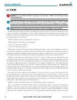
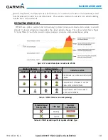
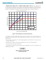
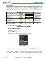
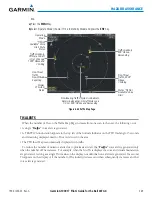
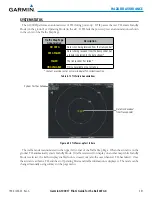
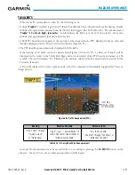
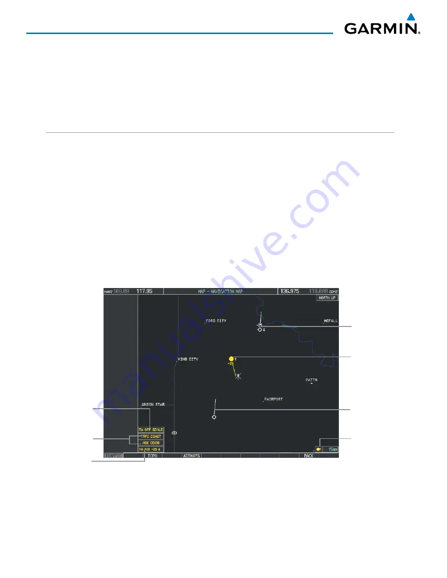
The altitude difference between the requesting aircraft and other intruder aircraft is displayed above/below the
traffic symbol in hundreds of feet. If the other aircraft is above the requesting aircraft, the altitude separation
appears above the traffic symbol; if below, the altitude separation appears below. Altitude trend is displayed as
an up/down arrow (for speeds greater than 500 fpm in either direction) to the right of the target symbol. Traffic
symbols for aircraft without altitude reporting capability appear without altitude separation or climb/descent
information.
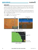
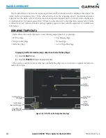
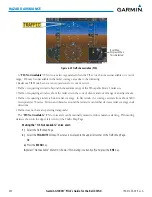
DISPLAYING TRAFFIC DATA
Traffic information can be displayed on the following maps (when TIS is operating):
• PFD Inset Map
• Navigation Map Page
• Traffic Map Page
• Trip Planning Page
• Nearest Pages
• Active Flight Plan Page
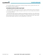
Displaying traffic information (maps other than the Traffic Map Page):
1)
Select the
MAP
Softkey.
2)
Select the
TRAFFIC
Softkey to display traffic data.
When traffic is selected on maps other than the Traffic Map Page, an icon is shown to indicate the feature is
enabled for display.
Figure 6-84 TIS Traffic on the Navigation Map Page
Traffic
Advisory
Traffic
Display
Enabled
Non-Threat
Traffic
“Non Bearing”
Traffic Advisory
Traffic Advisory
Off-Scale
Traffic Status
Banner Messages
Non-Threat
Traffic
Summary of Contents for G1000H
Page 1: ...G1000H Integrated Flight Deck Pilot s Guide Bell 407GX ...
Page 2: ......
Page 146: ...190 01255 00 Rev A Garmin G1000H Pilot s Guide for the Bell 407GX 134 AUDIO PANEL AND CNS ...
Page 518: ...190 01255 00 Rev A Garmin G1000H Pilot s Guide for the Bell 407GX 506 APPENDIX B Blank Page ...
Page 540: ...Garmin G1000H Pilot s Guide for the Bell 407GX 190 01255 00 Rev A I 6 INDEX Blank Page ...
Page 541: ......