Garmin G3X Pilot’s Guide
190-01115-00 Rev. K
260
Hazard Avoidance
System
Overview
Flight
Instruments
EIS
CNS
Interface
GPS
Navigation
Flight
Planning
Hazar
d
Avoidance
Additional
Featur
es
AFCS
Annun/Alerts
Appendix
Index
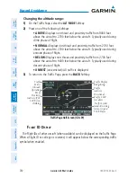
Changing the altitude range:
1)
On the Traffic Page, select the
ALT MODE
Softkey.
2)
Press one of the following Softkeys:
•
ABOVE:
Displays non-threat and proximity traffic from 9000 feet
above the aircraft to 2700 feet below the aircraft. Typically used during
climb phase of flight.
•
NORMAL:
Displays non-threat and proximity traffic from 2700 feet
above the aircraft to 2700 feet below the aircraft. Typically used during
enroute phase of flight.
•
BELOW:
Displays non-threat and proximity traffic from 2700 feet
above the aircraft to 9000 feet below the aircraft. Typically used during
descent phase of flight.
•
UNREST
(unrestricted)
:
All traffic is displayed.
3)
To return to the Traffic Page, press the
BACK
Softkey.
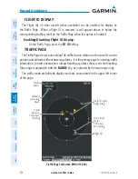
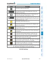
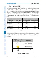
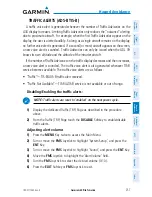
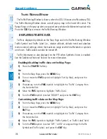
Traffic Page Half-Screen (GDL 39)
Traffic
Source
Traffic
Advisory
Traffic Display
Range Rings
Altitude/
Operating
Mode
Proximity
Advisory (PA),
400’ Below,
Climbing
Traffic System
Status Receiving
Air-to-Air and
TIS-B Traffic
Directional
Traffic, 2200
feet above
F
light
iD D
iSplay
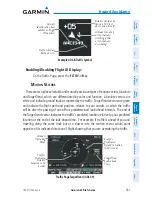
The Flight IDs of other aircraft (when available) can be displayed on the Traffic Page.
When a Flight ID or call sign is received, it will appear below the corresponding traffic
symbol when enabled.
Summary of Contents for G3X Touch
Page 1: ...G3X Pilot s Guide ...
Page 2: ......
Page 4: ......
Page 10: ...Garmin G3X Pilot s Guide 190 01115 00 Rev K Warnings Cautions Notes Blank Page ...
Page 16: ...Garmin G3X Pilot s Guide 190 01115 00 Rev K RR 6 Blank Page ...
Page 469: ......

