61
G500 Cockpit Reference Guide
190-01102-03 Rev C
SYMBOLS
SYMBOLS
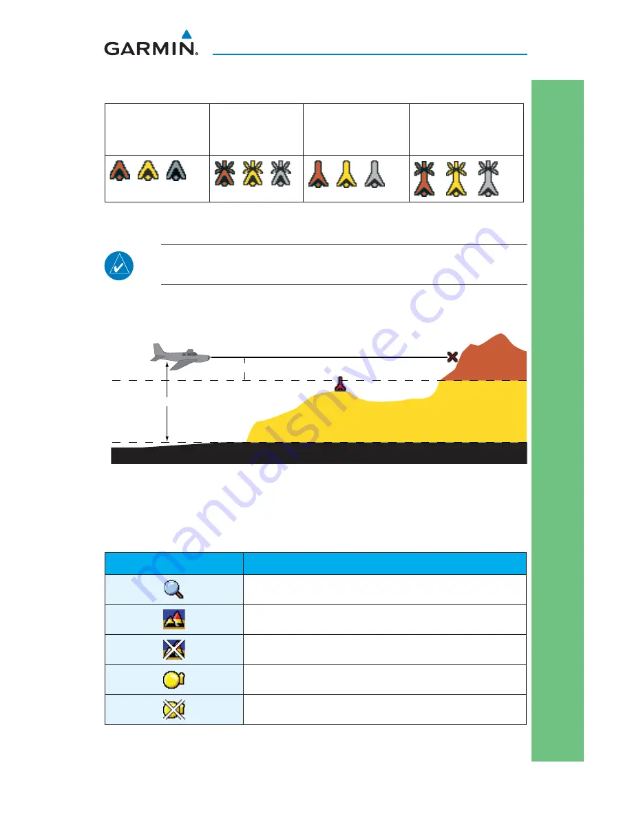
Terrain Obstacle Symbols
Unlighted Obstacle
(Height is less than
1000’ AGL)
Lighted Obstacle
(Height is less
than 1000’ AGL)
Unlighted Obstacle
(Height is greater
than 1000’ AGL)
Lighted Obstacle
(Height is greater
than 1000’ AGL)
NOTE:
Obstacles will be removed from the Terrain/TAWS page when
range
(RNG)
exceeds 10
NM
.
Potential Impact Point
Unlighted Obstacle
Projected Flight Path
1000 ft
100 ft Threshold
Terrain more than 1000 ft below the aircraft altitude (Black)
Terrain between 100 ft and 1000 ft below the
aircraft altitude (Yellow)
Terrain above or
within 100 ft
below the aircraft
altitude (Red)
Terrain Altitude/Color Correlation
Map Toolbar Symbols
Symbol
Description
Overzoom Indicator
Terrain Proximity Enabled and Available Indicator
Terrain Proximity Enabled and Not Available Indicator
Traffi c Enabled and Available Indicator
Traffi c Enabled and Not Available Indicator


