4-11
190-01150-02 Rev. J
Garmin G500H Pilot’s Guide
For
ewor
d
Sec 1
System
Sec 2
PFD
Sec 3
MFD
Sec 4
Hazar
d
Avoidance
Sec 5
Additional
Featur
es
Sec 6
Annun.
& Alerts
Sec 7
Symbols
Sec 8
Glossary
Appendix A
Appendix B
Index
4.5 Garmin Terrain-HSVT™ (Optional)
Garmin Terrain-HSVT™ refers to a subset of H-TAWS that meets the terrain
alerting requirements outlined in Section 7.b of AC 23-26. Terrain-HSVT is
a subset of H-TAWS that provides a FLTA functionality with visual alerting
and aural alerting. Terrain-HSVT is provided with Garmin Synthetic Vision
Technology (SVT™) functionality and not provided separately.
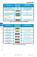
Terrain-HSVT alerting consists of the following alert types:
• Forward Looking Terrain Avoidance (FLTA) Alerting which consists of:
• Required Terrain Clearance (RTC) / Required Obstacle Clearance (ROC)
Alerting
• Imminent Terrain Impact (ITI) / Imminent Obstacle Impact (IOI)
Alerting
Terrain-HSVT is available in G500H GDU 620 SW version 4.00, and later.
Terrain-HSVT utilizes terrain and obstacle databases that are referenced to
mean sea level (MSL). Using the GPS position and GPS-MSL altitude, Terrain-
HSVT displays a 2-D picture of the surrounding terrain and obstacles relative to
the position and altitude of the aircraft. The GPS position and GPS-MSL altitude
are used to calculate and “predict” the aircraft’s flight path in relation to the
surrounding terrain and obstacles. In this manner, Terrain-HSVT can provide
advanced alerts of predicted dangerous terrain conditions. Detailed alert modes
are described later in this section.
To function properly Terrain-HSVT requires the use of databases specific to
helicopters and Terrain-HSVT. The databases required are:
1) 6 arc-second Terrain Databases
2) Helicopter Obstacle Database
3) Aviation Database including Heliports
Summary of Contents for G500H
Page 1: ...G500H Pilot s Guide ...
Page 365: ......

