3-12
Garmin G500H Pilot’s Guide
190-01150-02 Rev. J
For
ewor
d
Sec 1 System
Sec 2
PFD
Sec 3
MFD
Sec 4
Hazar
d
Avoidance
Sec 5
Additional Featur
es
Sec 6
Annun. & Alerts
Sec 7
Symbols
Sec 8
Glossary
Appendix A
Appendix B
Index
Auto Zoom
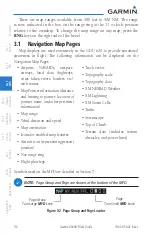
With a valid flight plan, the Auto Zoom feature will automatically change the
Navigation Map range depending on the distance to the next waypoint in the
flight plan. If enabled, it will also automatically zoom to the SafeTaxi zoom range
when the aircraft is on the ground. Auto Zoom can be overridden at any time by
manually zooming with the
RNG
keys or enabling OBS mode. Auto Zoom is re-
enabled once one of the following conditions is met:
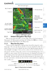
Land Data
The Land Data option selects whether detailed land features, such as rivers,
roads, cities, are displayed. Topo features, traffic, terrain, and obstacles will still
be displayed, even with Land Data turned off.
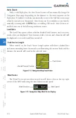
Track Vector Length
When turned on, the Track Vector Length option will show a dashed line
and arrow extending from the aircraft icon illustrating the current Track and the
distance the aircraft will travel in the selected time.
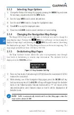
Track Vector
Aircraft Present Position
Figure 3-14 Navigation Map Track Vector
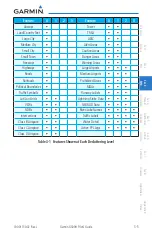
Wind Vector
The Wind Vector option when turned on will show a box in the top right
corner of the MFD indicating the wind direction and speed.
Wind Speed
Wind Direction
Figure 3-15 Navigation Map Wind Vector Display
Summary of Contents for G500H
Page 1: ...G500H Pilot s Guide ...
Page 365: ......

