Garmin GI 275 Pilot's Guide
190-02246-01 Rev. A
145
Hazard Avoidance
System Overview
Flight Instruments
EIS
Navigation
Hazar
d A
voidance
Autopilot
Additional F
eatur
es
Appendices
Index
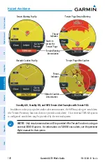
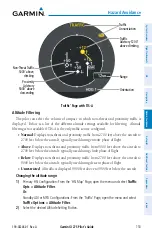
Item Displayed
Description
Terrain Function Identifier
Indicates the active terrain function on the 'Terrain' Page.
Terrain Overlay Icons
Indicates when terrain or obstacles are displayed for the
current range setting when enabled on the 'Map' Page and
the 'HSI Map' Page
Terrain Display Items
Selecting the 'Terrain' Page view:
1)
From the 'Terrain' Page, open the page menu and select
Terrain Options
.
2)
Select the
View
Button to toggle between 360
°
and Arc.
Displaying active flight plan information on the 'Terrain' Page:
1)
From the 'Terrain' Page, open the page menu and select
Terrain Options
.
2)
Select the
Flight Plan
Button to enable/disable the flight plan overlay setting.
Displaying the legend on the 'Terrain' Page:
1)
From the 'Terrain' Page, open the page menu and select
Terrain Options
.
2)
Select the
Legend
Button to enable/disable the display of the legend.
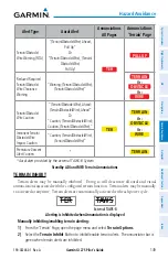
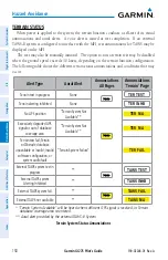
TERRAIN ALERTS
Alerts are issued when flight conditions meet parameters that are set by the configured
terrain function. Terrain alerts typically employ a CAUTION or a WARNING alert severity
level, or both. When an alert is issued, visual annunciations are displayed.
Forward Looking Terrain Avoidance (FLTA) compares the projected flight path as derived
from GPS data with terrain features and obstacles from the terrain and obstacle databases.
FLTA alerts are issued when the projected flight path conflicts with terrain or obstacles. The
projected flight path is a calculated area ahead of, to the sides, and below the aircraft. The size
of the projected flight path varies based on factors including ground speed (the path ahead is
larger when the ground speed is higher), whether the aircraft is level, turning, or descending,
and the proximity to the nearest runway along the current track. As the aircraft approaches
the runway, the projected flight path becomes narrower until FLTA is disabled or alerts are
inhibited. The system automatically disables FLTA alerts when the aircraft is less than 200 feet
above the destination runway elevation while within 0.5 nm of the approach runway or the
aircraft is between runway ends.
Summary of Contents for GI 275
Page 1: ...GI 275 Pilot s Guide ...
Page 2: ......
Page 4: ......
Page 12: ...Garmin GI 275 Pilot s Guide 190 02246 01 Rev A Warnings Cautions Notes Blank Page ...
Page 14: ...Garmin GI 275 Pilot s Guide 190 02246 01 Rev A Software License Agreement Blank Page ...
Page 16: ...Garmin GI 275 Pilot s Guide 190 02246 01 Rev A Record of Revisions Blank Page ...
Page 22: ...Garmin GI 275 Pilot s Guide 190 02246 01 Rev A vi Table of Contents Blank Page ...
Page 249: ......

