background image

owner’s 
manual
&
reference 
guide

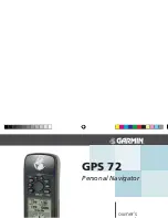
GPS 72

Personal Navigator

72 Manual covers Rev B.indd   1

9/25/2002, 2:35:12 PM

Summary of Contents for GPS 72

Page 1: ...owner s GPS 72 Personal Navigator...

Page 2: ...ored in any storage medium for any purpose without the express prior written consent of GARMIN GARMIN hereby grants permission to download a single copy of this manual and of any revision to this manu...

Page 3: ...Product Registration link on the home page Thanks for choosing the GARMIN GPS 72 If you have any questions or comments regarding the use of the GPS 72 you can visit our Web Site or contact our Custom...

Page 4: ...maintain full surveil lance of all driving conditions at all times and never become distracted by the GPS 72 to the exclusion of safe operating practices It is unsafe to operate the GPS 72 while you...

Page 5: ...quency energy and if not installed and used in accordance with the instructions may cause harmful interference to radio communications However there is no guarantee that interference will not occur in...

Page 6: ...r GPS 72 with the user in mind The GPS 72 is waterproof to IPX 7 standards oats and is rugged enough to endure the most trying use GARMIN s friendly user interface will allow you to be navigating with...

Page 7: ...Trip Computer 21 22 Tracks 23 24 Waypoints 25 Creating Waypoints 26 28 MapSource Info 41 Setup Menu General Tab 42 43 Setup Menu Time Tab 43 Setup Menu Units Tab 44 Setup Menu Location Tab 44 45 Setu...

Page 8: ...or out on the Map page 12 Recon gure the Map page display 12 17 Lear about the Pointer Page 18 Learn about the Highway Page 19 21 Setup and reset the Trip Computer 22 Clear the Track Log 23 Learn abo...

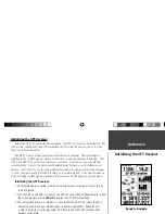
Page 9: ...orbital information is no longer valid If the Almanac is cold your unit may have trouble locking on to satellite signals If the unit is unable to receive enough satellite signals to determine its loc...

Page 10: ...to satellite signals select New Location When you select New Location another menu will be displayed This menu contains the options Automatic or Use Map If you select Automatic the unit will switch to...

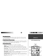
Page 11: ...individually Acquiring Satellites The receiver will be in this mode when the unit is turned on The receiver will remain in this mode until it has acquired at least 3 satellite signals 2D GPS Location...

Page 12: ...e signal The bars will be either shaded with a light grey or lled with solid black If the bar is grey it means that the GPS is receiving a signal from the satellite and is in the process of storing or...

Page 13: ...ccuracy New Location If you have moved the unit to another state province or country and you are having trouble locking onto satellite signals select New Location When you select New Location an optio...

Page 14: ...with greater detail The current Zoom Scale setting is displayed in the lower left corner of the Map Page If Overzoom is displayed under the scale no further map information is available To change the...

Page 15: ...lighted press ENTER to accept the selection Setup Map This option contains the Map Page Setup features The features are arranged on a tab menu making it easy to locate the different setup items The Ma...

Page 16: ...y be displayed when the Map Zoom Scale is at 500 ft or less Setup Map General Tab The General Tab contains the settings for Detail Orientation and Auto Zoom Below is a description of each feature To c...

Page 17: ...will be displayed in smaller increments as the Zoom Level on the Map Page is decreased The Zoom setting for this option determines when the grids will begin displaying on the Map Page If you select Au...

Page 18: ...o change a setting highlight the appropriate eld then press ENTER Make your new selection then press ENTER to accept the selection Navaids are items displayed on the Map that aid navigation Navaids ca...

Page 19: ...ed to de clutter the map If Auto is the selected Zoom set ting the Large and Medium cities will be displayed at a higher Map Zoom Scale setting Setup Map Other Tab The Other Tab contains the Text and...

Page 20: ...Arriving at Destination will be displayed It is important to note that the Compass Ring does not act as a true compass You must be moving for the Compass Ring and Pointer to update and provide accura...

Page 21: ...aligned with the White Line in the middle of the Highway and the Highway is pointed toward the top of the display When you are approaching a turn the message Approaching Turn will be displayed As you...

Page 22: ...the Graphic Highway will not be displayed Active Route If Off is selected the Graphic Highway will not be displayed Track Log If Off is selected the Track Log will not be displayed Saved Tracks If Of...

Page 23: ...ll Avg Total Time Max Speed and Odometer Trip Odom The Trip Odometer eld will display the total distance traveled since the Trip Computer was last reset Stopped Time The Stopped Time eld will display...

Page 24: ...total distance traveled since it was last reset Trip Computer Options To access the Trip Computer Options with the Trip Computer displayed press the MENU Key To select an option highlight the desired...

Page 25: ...clearing the Track Log will clean up the map Track Page Options To access the Track Options with the Tracks Page displayed press the MENU Key Delete Saved Track If you have saved tracks this option w...

Page 26: ...nce of the Saved Track Points shows the number of track log points in the Saved Track Area shows the area enclosed by the saved track If the track crosses over itself this value may be inaccurate Show...

Page 27: ...ind Nearest This option allows you to select how the Waypoint List will be displayed Find Nearest will display a list containing the nearest waypoints within a 100 mile radius The waypoints will be li...

Page 28: ...ew Waypoint Page will be displayed At this point you can edit the waypoint name symbol elevation and depth see page 29 for information on editing waypoints To save the waypoint to memory highlight the...

Page 29: ...ion Selecting Project Location allows you to change the location of the waypoint to a location that is a set bearing and distance from a speci ed point The Project Location page has four elds Location...

Page 30: ...e waypoints list or any MapSource data that may be loaded in the unit On the Project Location page enter a new bearing and distance When you have nished highlight Save and press ENTER This will return...

Page 31: ...and press ENTER to accept the changes Selecting a symbol Highlight the symbol eld and press ENTER Using the ROCKER select a symbol from the list and press ENTER The selected symbol will be displayed...

Page 32: ...tion about an item in the list highlight the item then press ENTER An Information window will be displayed showing the name address and phone number of the item To save the item as a waypoint press th...

Page 33: ...routes On the Routes Page you can create New routes determine how many empty routes that you have left and review a list of existing routes To display the Routes Page highlight Routes on the Main Men...

Page 34: ...nd ENTER a nal time to insert it into the route If you place the Map Pointer on a Map Feature the GPS 72 will only store that location in the route using the feature name as a reference These points a...

Page 35: ...th the Route Line active and the Map Pointer located on the waypoint highlighted on the Route Page With the map dis played press MENU to display the available options Review Remove Move and Next Revie...

Page 36: ...Only User Waypoints can be moved To move a waypoint place the Map Pointer on the waypoint then press ENTER This displays an options menu Highlight Move then press ENTER Place the Map Pointer at the d...

Page 37: ...e Will remove the selected route from the Routes Page Start Stop Navigation Will begin or end navigation of the selected route Proximity Proximity waypoints can be used to alert you when you are appro...

Page 38: ...lays the Go To Selection page Highlight Waypoint and press ENTER A list of Waypoints by Name will be displayed You have the option of selecting a waypoint by spelling out its name or display ing a lis...

Page 39: ...begin navigation to that point City Highlight City on the Go To Selection page and press ENTER A list of Cities by Name will be displayed Scroll through the displayed list make a selection and press...

Page 40: ...tial Menu lets you view information for Tides Sun and Moon or Hunt and Fish Main Menu Celestial Station Name Date Local Time Current Time Low Tide Curve Min Level Station Time MLLW Current Tide Level...

Page 41: ...current date and will intersect the tide graph to show their relation The tide curve will show as a shaded area with higher tides being taller and lower tides shorter The dark horizontal line with arr...

Page 42: ...ion of the moon in a light shade You may display this information for your current location or you can use the Map or Points Menu to select a location To display the location options press ENTER with...

Page 43: ...e and time of your choice MapSource Info The MapSource Info Page displays a list of the MapSource data stored in the unit and description of the highlighted list item You can choose to Show the data o...

Page 44: ...ry life While in Battery Saver mode the unit will not receive WAAS satellite signals Simulator When in Simulator mode the GPS receiver is turned off and the unit simulates satellite reception Use the...

Page 45: ...Make your selection then press ENTER to activate the selection Time Format The GPS 72 can display time in a 12 or 24 hour format Time Zone The Time Zone setting has nine options Atlantic Eastern Centr...

Page 46: ...ls The setting will be used in all elds that relate to direction Speed Filter Can be set to Auto or a User de ned setting If User is selected a Seconds eld will be displayed To enter a User de ned set...

Page 47: ...all performance North Reference Let s you select the reference used in calculating heading informa tion You can select Auto True Magnetic Grid or User Auto provides magnetic north heading references w...

Page 48: ...arriving at your destination Automatic will alert you between 15 and 90 seconds before depending on your speed Distance and Time alert you at the speci ed distance or time Off Course The Off Course Al...

Page 49: ...nd is displayed in the Baud eld Text Out Allows the GPS 72 to output simple text data that includes date time position and velocity information The Baud can be set to 1200 2400 4800 or 9600 bps RTCM I...

Page 50: ...ance Battery Life 16 Hours in Battery Saver Mode Receiver Differential ready 12 parallel channel receiver Acquisition Times Approx 15 seconds warm start Approx 45 seconds cold start Approx 5 minutes F...

Page 51: ...Replacement fuse is a AGC 3AG 2 0 Amp fuse Interfacing The following formats are supported for connection of external devices GARMIN proprietary Differential GPS DGPS NMEA 0183 version 2 3 ASCII Text...

Page 52: ...5 12 W172 5 to W157 5 11 W157 5 to W142 5 10 W142 5 to W127 5 9 W127 5 to W112 5 8 W112 5 to W097 5 7 W097 5 to W082 5 6 W082 5 to W067 5 5 W067 5 to W052 5 4 W052 5 to W037 5 3 W037 5 to W022 5 2 E0...

Page 53: ...6 Canton Astro 1966 Phoenix Islands Cape Cape South Africa Cape Canavrl Cape Canaveral Florida Bahama Islands Carthage Carthage Tunisia CH 1903 CH 1903 Switzerland Chatham 1971 Chatham 1971 Chatham Is...

Page 54: ...sle of Man Scotland Shetland Isl Wales Pico De Las Nv Canary Islands Potsdam Potsdam Germany Ptcairn Ast 67 Pitcairn Astro 67 Pitcairn Prov S Am 56 Prov So Amricn 56 Bolivia Chile Colombia Ecuador Guy...

Page 55: ...ion to a GOTO destination or the next waypoint in a route Elevation Height above mean sea level MSL ETA Estimated Time of Arrival The estimated time you will reach your destination waypoint based on c...

Page 56: ...e en route Time to Dest The estimated time required to reach a GOTO destination or the nal waypoint in a route Time to Next The estimated time required to reach a GOTO destination or the next waypoint...

Page 57: ...to have the unit repaired Dragging Anchor is the message displayed when the distance set in the Anchor Alarm is exceeded Lost Satellite Reception The unit is unable to continue receiving satellite sig...

Page 58: ...clear the track log and turn track recording on This will only be displayed when the track recording setting is set to Stop When Full Track Truncated A complete uploaded track will not t in memory The...

Page 59: ...verts GPS coordinates to LORAN TDs for those who have a collection of LORAN xes for favorite shing spots and other waypoints recorded as TDs You can display your position as a TD or enter waypoints as...

Page 60: ...ct enter the desired setting then press ENTER 4 When done press the PAGE Key to return to the Main Menu If the active GRI Chain secondary stations or offsets have been changed since the waypoint was c...

Page 61: ...bracket can rotate 360 and tilt more than 45 backward or forward Carrying Case Protects the GPS 72 when not in use Power Data Cable Wiring harness can be used to hardwire the unit to auxiliary power...

Page 62: ...verage Location 27 B Battery Saver Mode 42 Bearing Line 17 Beeper 43 C Cautions 2 Celestial Page 38 Changing Data Fields 13 18 20 Cities 30 Course Line 17 Clearing the Track Log 23 Creating Waypoints...

Page 63: ...a Waypoint 36 GPS Accuracy 48 GPS Information Page 9 GPS Information Page Options 11 Grid Map Page 15 Grid Labels 15 H Heading North Reference 45 Heading Line 17 I IN Key 12 Initialize the Receiver 7...

Page 64: ...Station 39 Nearest Waypoint List 25 36 O Odometer Trip 22 Off Course Alarm 46 Orientation 14 Overzoom 12 P Plan Route 35 Pointer Page 18 Pointer Page Options 18 Points of Interest 16 30 Power Data Cab...

Page 65: ...Software Version 41 Speed Filter 44 Sun and Moon 40 System Info Serial Number 41 System Mode 42 T Temperature Settings 44 Text Setting 13 Tides 38 Track Back 24 Track Log 16 Trip Computer 21 U Units T...

Page 66: ...IDENTAL SPECIAL INDIRECT OR CONSEQUENTIAL DAMAGES WHETHER RESULTING FROM THE USE MISUSE OR INABILITY TO USE THIS PRODUCT OR FROM DEFECTS IN THE PRODUCT Some states do not allow the exclusion of incide...

Page 67: ...Inc 1200 East 151st Street Olathe Kansas 66062 U S A GARMIN Europe Ltd Unit 5 The Quadrangle Abbey Park Industrial Estate Romsey SO51 9AQ U K For the latest free software updates throughout the life...

Reviews: