10
GPSMAP 3005C Owner’s Manual
B
ASIC
O
PERATION
>
U
SING
THE
GPSMAP 3005C
Using the Map Pointer
Use the map pointer to pan away from your current location and scroll to other
map areas around the world (even outside of your current detail coverage). As
you pan past the edge of the current map display, the screen actively scrolls
forward to provide continuous map coverage. An hourglass symbol appears by
the pointer while the unit is busy drawing new map detail.
Controlled by the
ROCKER
, the map pointer is an important tool that can be
used to pan to other map locations, mark and edit waypoints and routes, and
review location data of on-screen map items and waypoints.
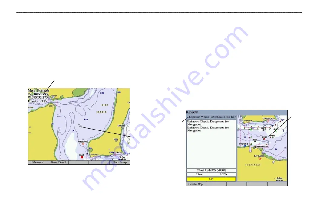
Map item name, pointer coordinates,
distance, and bearing
Map
pointer
To move the map pointer:
Press the
ROCKER
to move the map pointer up, down, left, right, or
diagonally.
As you move the map pointer, the distance and bearing from your current
location to the map pointer are shown in the upper-left corner of the map, with
the map pointer’s location coordinates. Keep in mind that when the map pointer
is stationary, the distance and bearing from your present location changes as your
boat moves. The map pointer can also be used to snap to on-screen waypoints and
map items, allowing you to review a selected location directly from the map.
To select an on-screen waypoint or map item with the map pointer:
1. Use the
ROCKER
to move the pointer to the waypoint or map item. When
a waypoint or map item is selected, it is highlighted on-screen with the
name and location shown.
2. Press
ENTER
to view details of the map item. When using BlueChart or
MapSource data, or if waypoints are grouped tightly together due to the
Range setting, additional tabs appear on the Review Waypoint Page. Use
the
ROCKER
to highlight the individual tabs to view the information and
additional options.
Additional
information
tabs
Map
window
Summary of Contents for GPSMAP 3005C
Page 1: ...GPSMAP 3005C Owner s Manual...
Page 111: ......


