35
Section 2
TERRAIN Operation
General Database Information
The Garmin TERRAIN system uses terrain and obstacle information supplied by government sources.
The data undergoes verification by Garmin to confirm accuracy of the content, per TSO-C151b.
How-
ever, the information displayed should never be understood to be all-inclusive. Pilots must familiar-
ize themselves with the appropriate sectional charts for safe flight.
NOTE: The data contained in the terrain and obstacle databases comes from government
agencies. Garmin accurately processes and cross-validates the data, but cannot guarantee
the accuracy and completeness of the data.
The terrain/obstacle databases are contained on a datacard which is inserted in the right-most slot of
the 400/500 Series units.
Database Versions
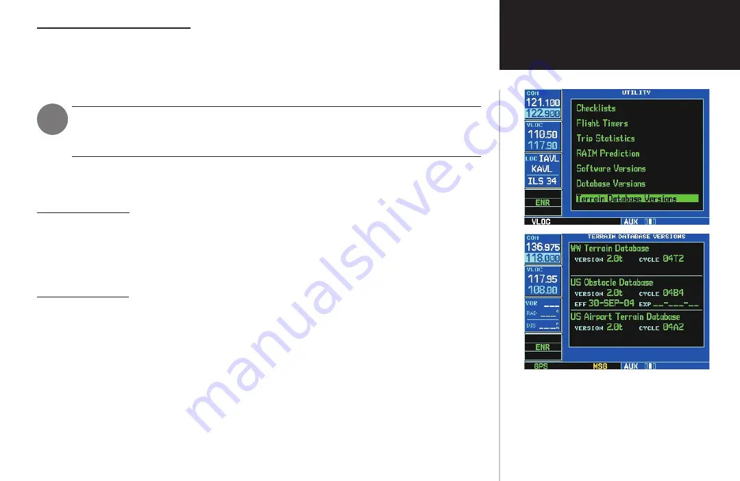
The version and area of coverage of each terrain/obstacle database is shown on the Terrain Data-
base Versions Page, located in the AUX Page Group (Figure 2-7). Databases are checked for integrity at
power-up. If a database is found to be missing and/or deficient, the TERRAIN system fails the self-test
and issues a failure message (see page 41).
Database Updates
Terrain/obstacle databases are updated periodically with the latest terrain and obstacle data. Visit the
Garmin website to check for newer versions of terrain/obstacle databases (compare database cycle num-
bers to determine if a newer version is available). Updated terrain data cards may be obtained by calling
Garmin at one of the numbers listed in the front of this document.
To update the terrain or obstacle database:
1. Acquire a new terrain data card from Garmin.
2. Turn off the power to the 400/500 Series unit.
3. Remove the old terrain data card from and insert the new card into the right-most slot of the
400/500 Series unit.
4. Turn on the 400/500 Series unit and verify that the TERRAIN system passes the self-test.
Figure 2-7: TERRAIN Database Information


