


8
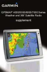
GPSMAP 4000/5000/6000/7000 Series Weather and XM Satellite Radio Supplement
XM WX Satellite Weather and Cellular Weather
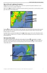
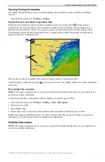
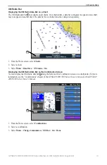
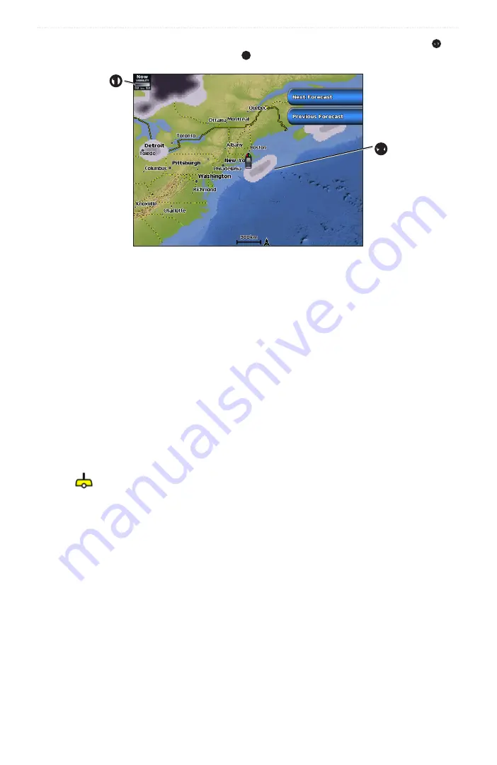
Visibility is the forecast maximum horizontal distance that can be seen at the surface, as shown in the legend
➊
on
the left of the screen. Variations in the visibility shading
➋
show the forecast change in surface visibility.
➊
➋
Viewing Visibility Information
From the Home screen, select
Weather
>
Visibility
.
Viewing Forecast Visibility Information for Another Time Period
1. From the Home screen, select
Weather
>
Visibility
.
2. Complete an action:
• To view the visibility forecast for the next 12 hours, select
Next Forecast
, and to view forecasts up to 48
hours, in 12-hour increments, select
Next Forecast
again.
• To view the visibility forecast for the previous 12 hours, select
Previous Forecast,
and to view previous
forecasts, up to 48 hours ago, in 12-hour increments, select
Previous Forecast
again.
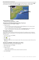
Viewing Buoy Reports
Report readings are taken from buoys and coastal observation stations. These readings are used to determine air
temperature, dew point, water temperature, tide, wave height and period, wind direction and speed, visibility, and
barometric pressure.
1. From the Home screen, select
Weather
.
2. Select a weather chart.
3. Select
.
4. Select
Review
>
Buoy
.
Review
does not appear if the cursor is not near an object. If the cursor is near only one object, the name of the
buoy appears.
Viewing Local Weather Information near a Buoy
You can select an area near a buoy to view forecast information.
1. From the Home screen, select
Weather
.
2. Select a weather chart.
3. Complete an action:
• Select a location on the chart.
• Drag the screen to pan to a new location, and select the location on the chart.
4. Select
Local Weather
.
Summary of Contents for GPSMAP 4000 Series
Page 1: ...GPSMAP 4000 5000 6000 7000 Series Weather and XM Satellite Radio supplement...
Page 21: ......
Page 22: ......
Page 23: ......


