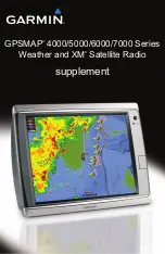

GPSMAP 4000/5000/6000/7000 Series Weather and XM Satellite Radio Supplement
1
XM WX Satellite Weather and Cellular Weather
XM WX Satellite Weather and Cellular Weather
WARNING
The weather information provided through this product is subject to service interruptions and may contain errors,
inaccuracies, or outdated information, and consequently should not be relied upon exclusively. Always use common
sense while driving or navigating, and check alternate weather information sources prior to making safety-related
decisions. You acknowledge and agree that you shall be solely responsible for use of the weather information
and all decisions taken with respect to driving or navigating in weather. Garmin will not be responsible for any
consequences of using the weather data.
Cellular Weather
Cellular weather provides data through wireless service providers. An antenna, such as the Garmin GDL
®
40,
communicates with nearby cellular towers to receive the weather data. The weather data for each feature comes
from reputable weather data centers such as the National Oceanic and Atmospheric Administration (NOAA)
National Weather Service, Environment Canada, and Météo-France.
To view cellular weather, you must initially select an annual subscription service online at
. You may purchase a day pass directly from the chartplotter. A day pass provides 24 hours of
continuous weather data. Refer to the antenna installation instructions or the instructions at
to
activate this service.
XM WX Satellite Weather
A Garmin XM satellite weather receiver and antenna receives XM WX Satellite Weather data and shows it on
various Garmin devices, including the Navigation chart on a chartplotter. The weather data for each feature comes
from reputable weather data centers such as the National Weather Service and the Hydrometeorological Prediction
Center. For more information, go to the XM WX Satellite Weather Web site at
.
To view XM WX Satellite Weather information, you must have a subscription to XM WX Satellite Weather, and
you must have a Garmin XM satellite weather receiver connected to a chartplotter.
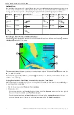
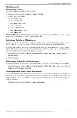
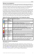
Weather Features
Feature
XM WX Satellite
Weather
Cellular
Weather
)
X
X
Satellite Cloud Cover (
)
X
X
European, Canadian, and USA Radar (
X
X
Lightning (
X
X
Severe Storm Tracks (
)
X
Canada and USA Warnings (
)
X
X
Hurricane Track (
)
X
X
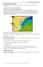
Surface WX Analysis (
X
Sea Surface Pressure Forecast (
)
X
X
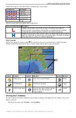
City Forecasts (
X
X
Surface Wind Vectors (
X
X
Wave Direction and Wave Direction Forecast (
)
X
X
Wave Height and Wave Height Forecast (
)
X
X
Wave Period and Wave Period Forecast (
)
X
X
)
X
) and Visibility Forecast (
)
X
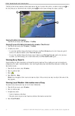
National Weather Station Marine Local Forecast (
)
X
X
Summary of Contents for GPSMAP 4000 Series
Page 1: ...GPSMAP 4000 5000 6000 7000 Series Weather and XM Satellite Radio supplement...
Page 21: ......
Page 22: ......
Page 23: ......