


33
Getting Started
33
Reference
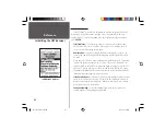
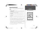
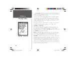
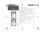
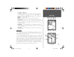
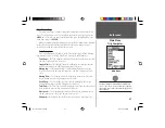
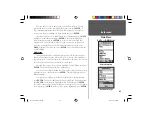
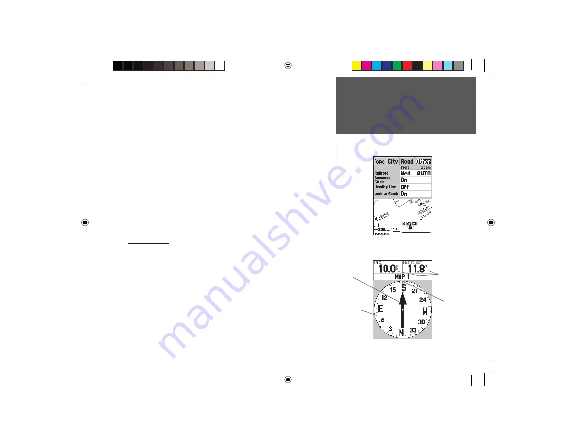
Setup Map — ‘Other’ Tab
The ‘Other’ Tab contains the ‘Text’ and ‘Zoom’ settings for Railroad and an
On/Off setting for the Accuracy Circle. To change a setting, highlight the
appropriate fi eld then press
ENTER
. Make your new selection, then press
ENTER
to accept the selection.
Railroad —
controls the display of railways lines on the Map Page.
Accuracy Circle —
The Accuracy Circle is displayed around the Location
Triangle on the Map Page. The Accuracy Circle depicts the estimated accuracy
of the location. If your current location is matched to a road, no Accuracy
Circle will be displayed.
Heading Line —
If the Heading line is ‘On’, a line showing your current
heading will be projected on the map from the current location. The Heading
line is a thin black line.
Lock to Roads —
If ‘Lock to Roads’ is ‘On’, the unit will try to match your
location to a road.
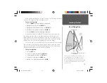
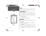
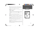
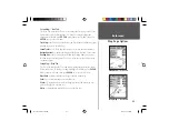
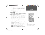
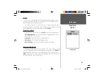
Pointer Page
The Pointer Page is best used for navigation when a straight line course can
not be followed. The Pointer Page has User Selectable Data Fields along the top, a
Status Bar, Compass Ring and a Pointer.
The Compass Ring is a graphic display of your current track. As you change
direction, the Compass Ring will rotate, aligning your track with the vertical line.
As you change direction, the Pointer will always point toward the active waypoint.
When you are going directly toward the active waypoint, the Pointer is aligned
with the vertical line in the Compass Ring. When you arrive at the waypoint, a
message ‘Arriving at Destination’ will be displayed. It is important to note that
the Compass Ring does not act as a true compass. You must be moving for the
Pointer to update and correctly point towards your destination.
Setup Map — ‘Other’ Tab
User Data
Fields
Compass
Ring
Pointer
Vertical
Line
Map Page Options
Pointer Page
190-00230-00 Rev B.indd
07/25/01, 9:50 AM
33


