background image

29

Que Applications

QueTracks

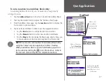
Saved Track Details Page 

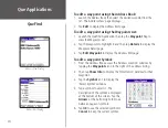
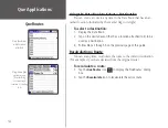
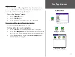
Saved Track Details

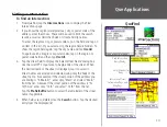
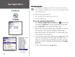
•   Tap the 

QueTracks

 icon to display the ‘Tracks’ page.  Then tap 

the desired track in the ‘Saved Tracks’ list to display the ‘Saved 
Track Details’ page.

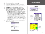
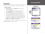
•  To rename any Track, tap the name at the top of the ‘Saved Track 

Details’ page and then use the Graffiti

®

 2 input area to enter a 

new name.

•   To assign a new color to the track when it is displayed on a map, 

tap the Color name at the top of the page.  Tap the desired color 
from the list to select and close the list.

•  If the ‘Show On Map’ option is checked, the saved track is 

displayed on the map.

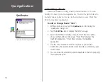
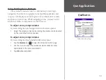
Using QueTrack Preferences

You may set QueTrack preferences to adjust how the track log wraps 

when recording and the interval at which a track point is created.  

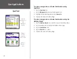
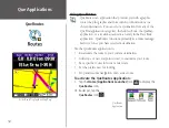
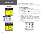
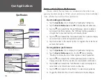
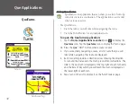
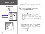
To view the QueTracks Preferences:

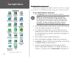
1.  Tap 

Home (Applications Launcher) 

icon 

 repeatedly to 

display the 

Prefs

 icon. 

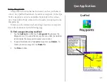
2.  Tap 

Preferences

.

3.  Tap the   symbol and select 

Tracks

 from the drop-down list.

4.  Change the preferences as desired.  

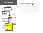
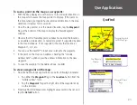
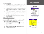
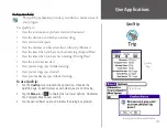
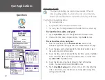
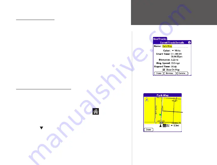
Review Track  Page 

Track line

Summary of Contents for iQue 3200

Page 1: ...iQue 3200 integrated handheld Que applications guide...

Page 2: ...such electronic or printed copy of this manual must contain the complete text of this copyright notice and provided further that any unauthorized commercial distribution of this manual or any revisio...

Page 3: ...Garmin You acknowledge that the Software is the property of Garmin and is protected under the United States of America copyright laws and international copyright treaties You further acknowledge that...

Page 4: ...ES CONTAINED HEREIN ARE EXCLUSIVE AND IN LIEU OF ALL OTHER WARRANTIES EXPRESS OR IMPLIED OR STATUTORY INCLUDING ANY LIABILITY ARISING UNDER ANY WARRANTY OF MERCHANTABILITY OR FITNESS FOR A PARTICULAR...

Page 5: ...any package pur chased through an online auction To obtain warranty service contact your local Garmin authorized dealer Or call Garmin Customer Service at one of the numbers shown to the right for sh...

Page 6: ...radio communications However there is no guarantee that inter ference will not occur in a particular installation If this equipment does cause harmful interference to radio or television reception wh...

Page 7: ...t use MAP DATA INFORMATION One of the goals of Garmin is to provide customers with the most complete and accurate cartography that is available to us at a reasonable cost We use a combination of gover...

Page 8: ...f airbag deployment Airbags expand with a rapid force that can propel objects in their path towards the vehicle driver or passengers caus ing possible injury Refer to airbag safety precautions contain...

Page 9: ...and software instal lation instructions and other important details Before reading the other manuals read the Setup Guide printed on the Setup CD case Operating Instructions The Operating Instructions...

Page 10: ...Que Applications Guide vii Read This First Setup Guide vii Operating Instructions vii Table of Contents viii Overview 1 2 Setting Up your iQue 3200 1 Setting up and Customizing your iQue 3200 1 Initia...

Page 11: ...n 19 Finding Points of Interest 20 Using Waypoints 21 QueTracks 28 Using QueTracks 28 Saved Track Details 29 Using QueTrack Preferences 29 QueRoutes 30 Using QueRoutes 30 Creating Routes 31 Using QueM...

Page 12: ...Map Data 46 47 Map Install 46 Using Map Install to Download Map Data 46 MapSource 47 Using MapSource to Download Map Data 47 Appendix 48 52 Speci cations 48 WAAS and DGPS 50 What is WAAS 50 What is D...

Page 13: ...s Any time you have traveled more than 600 miles with the GPS receiver turned off the iQue handheld must again nd its location by re initializing The initialization time can be shortened by using the...

Page 14: ...tton options check list 4 Use the stylus to place a check in the boxes for the Que applications you desire to cycle through Use the arrows to change the order of the Que Applications The application a...

Page 15: ...ength of each satellite being received Use QueGPS to Observe the status of GPS satellite signal reception View the current date and time Determine your current location coordinates and their accuracy...

Page 16: ...ellites in the sky overhead with your position in the center of the two circles The outer circle indicates the horizon while the inner circle a position 45 from the horizon The numbers displayed indic...

Page 17: ...AAS satellite signals are being received and a 3D location x is established 3D Differential GPS Location is displayed When only enough satellite signals are being received to determine a 2D location x...

Page 18: ...Preferences option to display the GPS Preferences Menu 2 Observe the list of options with check boxes Tap WAAS Enabled to enable the Wide Area Augmentation System operating mode See Additional Inform...

Page 19: ...ou choose Use Map use the stylus to pan the map to your current general location and tap to place a new location arrow there 3 Tap the Done button to complete initialization Entering a New Elevation T...

Page 20: ...ne when navigating Highlight and view information about locations on the map To Display the QueMap Application 1 Press the Que Hard button on the front of the handheld to display QueMap Or Use the App...

Page 21: ...he North arrow indicates the map orientation When the Pan Map with Stylus mode is selected drag the stylus across the screen to pan the map with the movement of the stylus Tap the stylus on the map to...

Page 22: ...only Map with Navigation and Data Fields showing Full Map only TaptheWaypointFlagonthemaptoolbartodisplaythe Mark Waypoint entry window for your current location Position Arrow ora NewWaypoint entrywi...

Page 23: ...exposes the part of the map previously out of view Lift the stylus to stop panning Tap the View Area icon to allow you to de ne an area on the map with the stylus that will be enlarged when you lift t...

Page 24: ...pplication tap Menu icon 2 Tap Preferences 3 View and change the preferences as needed To open a different QueMap Preferences page such as the Navigation Preferences tap the symbol before General as s...

Page 25: ...ing Accuracy Circle de nes your location within the con nes of the circle Circle size is determined by map resolution and GPS receiver accuracy and Basemap to determine your preferences Location Forma...

Page 26: ...a items such as Waypoints Cities and Points of Interest to nd desired destinations and navigate to them using the QueRoutes application Find items contained in the map data and in the Address Book Vie...

Page 27: ...available Search Methods when navigating a route Enter a distance range to search around the current route 3 You can shorten your search list by entering the name of the item at the top of the page in...

Page 28: ...at the top of the page in the Name or Containing eld 4 When the list is displayed highlight a single city 5 Then tap Details to display an information page that provides a map showing the city locati...

Page 29: ...e regions city or postal code tap on the selector trigger then tap on an item in the list If you select a city the region eld is hidden to show the region eld again tap on the city name and tap the Us...

Page 30: ...s you are nding is E Main St enter only Main and select Main from the list Likewise if the street portion of the address is N 13th Ave enter only 13th and select 13th from the list Tap the Pre x Suf x...

Page 31: ...tap the city name and tap Use All To again search all regions or postal codes tap on the region or postal code eld and then tap Use All 3 Tap the street eld to display the Select Street Name dialog b...

Page 32: ...ap options 2 Tap the desired category to display the list of items in that category or the entry dialog for Addresses or Intersections 3 If you selected a category with a list you are given a choice o...

Page 33: ...ns are displayed in the Waypoints list To learn speci c information about saving a location as a waypoint refer to the instructions on the following page To nd a waypoint using QueFind 1 Tap the QueFi...

Page 34: ...he waypoint automatically named as Waypoint Each subsequently marked waypoint will be named Waypoint 1 2 3 etc 3 You can use the Graf ti 2 input area to rename the waypoint to one more descriptive of...

Page 35: ...med the location as an address intersection or named map item if supported by data in the map database If not supported it names the location as Waypoint 1 2 3 etc 4 You can use the Graf ti 2 input ar...

Page 36: ...then tap Details to display the Waypoint Detail page 3 Tap Edit Waypoint to display the Address Edit page To edit a waypoint Symbol 1 From the Address Book access the Address Location window by tappin...

Page 37: ...the Edit Location window You have three methods to change the waypoint location Tap Find to use QueFind to nd a location for the waypoint Tap Manual to enter new location coordinates The Legal Value t...

Page 38: ...d icon 2 Tap the Waypoint Flag to view the Waypoints list 3 Highlight the desired waypoint and tap Route To 4 Observe the route on the Map Page To select a waypoint as a Route Destination using the Ad...

Page 39: ...From the Address View page tap the Location button to display the Set Location options window 4 You have three methods in which to set the waypoint location Tap the Find button to use QueFind to nd a...

Page 40: ...y the QueTracks icon in the Que Applications Launcher 2 Tap the QueTracks icon to display the Tracks page 3 Observe the Track Log capacity bar graph indicating the amount of Track Log used and the per...

Page 41: ...d on a map tap the Color name at the top of the page Tap the desired color from the list to select and close the list If the Show On Map option is checked the saved track is displayed on the map Using...

Page 42: ...o an entry in the Date Book application QueRoutes functions primarily as a route manage ment tool once you have selected a destination Use the QueRoutes application to Recalculate the route to your cu...

Page 43: ...QueFind application search categories Refer to the QueFind section of this manual for detailed instructions on searching for items 2 Tap the QueRoutes icon to display the QueRoutes dialog box Tap the...

Page 44: ...s tap the location on the map that you want to use as a destination 3 Tap the QueRoutes icon to display the QueRoutes dialog box 4 Tap the Route To section at the top of the dialog box The name displa...

Page 45: ...desired Address Book record to display the Address View 3 Tap the QueRoutes icon 4 Tap the Route To area at the top of the dialog box The name displayed depends on the item selected 5 The QueMap appli...

Page 46: ...to its right To select a destination 1 Display the Date Book 2 Tap on the desired event that has a location attached to it to be used as a destination 3 Follow Steps 3 though 6 on the previous page of...

Page 47: ...Detour option 1 Tap the QueRoutes icon 2 Tap the Detour option 3 Tap the distance to avoid roads used in the current route Stopping and Resuming Route Navigation You can stop navigating a route at any...

Page 48: ...s 1 While a route is active tap the QueRoute icon to display the QueRoutes dialog box 2 Tap the Edit Vias icon to display the Edit Vias page 3 Select the method of adding a via point from the two opti...

Page 49: ...con to display the Saved Routes List 2 Tap the Save Active button at the bottom of the page 3 A Save Active Route dialog box displays Rename the route if desired and then tap OK to save to the Saved R...

Page 50: ...ot following roads 4 Tap the icon beneath the Calculate Routes For option to display and select from a list of transportation options 5 Tap the box next to the Avoid options to toggle a check mark and...

Page 51: ...you may need to adjust the volume to compensate for road noise etc To adjust voice prompt volume If you are using the Auto Navigation Kit with remote speaker 1 Adjust the volume as desired by turning...

Page 52: ...to display the QueTurns icon Tap the QueTurns icon to display the Turns page Or Press the Que Hard button when a route is active 2 If you are actively navigating a route a list of turns that you will...

Page 53: ...ip Distance View the time when you have not been moving Stopped Time View the time when you have been moving Driving Time View the total time traveled View your average speed while traveling View your...

Page 54: ...nd year display Tap the OK to close To set the time date and year 1 From the QueClock tap the Set Date Time button on the QueClock application to display the Date Time Preferences page 2 To set the da...

Page 55: ...d the alarm will be set for the following day 4 Select the frequency for which the alarm will be repeated Tap Once to choose from Once Daily once each day of the full seven day week or Mon to Fri Mond...

Page 56: ...ap Use Current Date and Time to view sun and moon information for your current location and date Tap Animate by Hour to view the sun and moon locations by the hour Tap Animate by Day to view the sun a...

Page 57: ...for a Location and Date 1 Tap the QueHunt Fish icon to view hunting and shing information for your current location and date The day s Prediction Best Times and Good Times are displayed 2 Tap the dat...

Page 58: ...ad the information on the Welcome window It will help to determine your next step For certain maps those provided with your new unit you must use an Unlock Code to open the map data You may have alrea...

Page 59: ...fo Then the Version button Locate Unit ID on the page Your ID begins only after the dash example 0G32 00000000 The MapSource operating software version 5 4 and above can be used to download maps to th...

Page 60: ...te Book Memo Pad Palm Reader and To Do List Other 3rd party apps Astraware Game Pack Documents To Go by DataViz powerOne Personal Calculator Star Caddy Splash Wallet Vindigo WorldMate DataViz Mail and...

Page 61: ...te your position Acquisition times Warm Approximately 15 seconds Cold Approximately 45 seconds AutoLocate Approximately 5 minutes Update rate 1 second continuous GPS accuracy Position 15 meters 95 typ...

Page 62: ...f 2 3 meters For more informa tion go to http gps faa gov Programs WAAS waas htm What is Differential GPS DGPS The U S and Canadian governments among others have set up Differential GPS DGPS stations...

Page 63: ...igating and comparing the GPS coordinates to a map chart or other reference the map datum in the GPS unit should be set to the same datum as the map or chart to insure the most accurate navigation Wha...

Page 64: ...ocation Formats When you save any QueMap or QueFind item as a Waypoint loca tion coordinates are automatically assigned using information contained in the mapping database either stored in your unit o...

Page 65: ...a Route 36 D Date 42 Date Book 34 Daylight Savings 42 Detour 35 DGPS 50 Differential GPS 50 Digital Card 13 46 Display Format 8 10 Download Map 46 47 E Entire Log 28 F FCC Compliance Information iv F...

Page 66: ...11 Position Coordinates 13 Postal Code 17 Precautions v Preferences 2 38 Guidance 38 Location 13 51 52 QueClock 42 QueGPS 6 QueMap 12 13 QueTracks 29 Que button 2 Routing 38 Units 1 Pre x Suf x 18 19...

Page 67: ...avigation 35 Street Names 18 19 Street Number 17 T Time 42 Time Date and Year 42 Time Zone 42 Track Log 28 Track Up 8 9 Transportation Options 38 Turn Preview 38 40 Turn the Receiver On 1 U Units 1 Un...

Page 68: ...armin com Copyright 2004 Garmin Ltd or its subsidiaries Garmin International Inc 1200 East 151st Street Olathe Kansas 66062 U S A Garmin Europe Ltd Unit 5 The Quadrangle Abbey Park Industrial Estate R...

Reviews: