background image

3

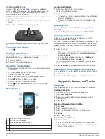
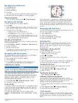
Swipe left or right to view additional applications and 

widgets.

4

Hold an application or widget, and drag it to the desired 

location on the home screen.

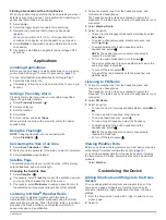
Rotating the Screen

Rotate your device to view in horizontal (landscape) or 

vertical (portrait) mode.

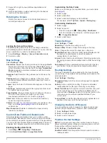
Locking the Screen Orientation

The default setting allows the screen to change orientation 

automatically based on the device orientation. You can lock the 

screen orientation in portrait or landscape mode.

1

Select 

Settings

 > 

Display

 > 

Screen Orientation Lock

.

2

Select an option.

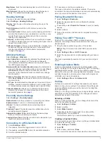
Map Settings

Select 

Settings

 > 

Map

.

Orientation

: Adjusts how the map is shown on the page. 

North 

Up

 shows north at the top of the page. 

Track Up

 shows your 

current direction of travel at the top of the page. 

Automotive 

Mode

 shows and automotive perspective with the direction 

of travel at the top.

Guidance Text

: Sets when the guidance text is shown on the 

map.

Dashboard

: Sets a dashboard to display on the map. Each 

dashboard shows different information about your route or 

your location.

Layers

: Sets the types of information that appears on the map 

page.

Auto Zoom

: Automatically selects the appropriate zoom level 

for optimal use on your map.

Zoom Buttons

: Shows or hides the zoom buttons on the map. 

When the zoom buttons are hidden, you must use 

touchscreen gestures to zoom in and out (

page 2

).

Detail

: Sets the level of detail on the map. More detail may 

cause the map to draw slower.

Vehicle

: Changes the icon that represents your position on the 

map. Go to 

www.garmingarage.com

 to download more 

vehicle icons.

Map Information

: Enables or disables the maps currently 

loaded on the device.

Custom Data Fields and Dashboards

Data fields display information about your location or other 

specified data. Dashboards are a custom grouping of data that 

can be helpful to a specific or general task, such as geocaching.
You can customize the data fields and dashboards of the map, 

compass, trip computer, elevation plot, and the status page.

Enabling the Map Data Fields

1

Select 

Map

 >   > 

Setup Map

 > 

Dashboard

.

2

Select 

Small Data Fields

 or 

Large Data Fields

.

Customizing the Data Fields

Before you can change the map data fields, you must enable 

them (

page 8

).

1

Select a page.

2

Select a data field.

3

Select a data field category and a data field.
For example, select 

Trip Data

 > 

Speed - Moving Avg.

.

Customizing Dashboards

1

Select a page.

2

Select an option:
• From the map, select   > 

Setup Map

 > 

Dashboard

.

• From the compass, trip computer, or status page, select 

 > 

Change Dashboard

.

3

Select a dashboard.

Tracks Settings

Select 

Settings

 > 

Tracks

.

Recording

: Turns track recording on or off.

Show on Map

: Shows or hides the track log on the map.

Color

: Changes the color of the track line on the map.

Record Method

: Sets a track recording method. 

Auto

 records 

the tracks at a variable rate to create an optimum 

representation of your tracks.

Interval

: Sets a track log recording rate. Recording points more 

frequently creates a more-detailed track, but fills the track log 

faster.

Auto Archive

: Sets an automatic archive method to organize 

your tracks. Tracks are saved and cleared automatically.

Routing Settings

The device calculates routes optimized for the type of activity 

you are doing. The available routing settings vary based on the 

activity selected.
Select 

Settings

 > 

Routing

.

Navigation Voice

: Sets the voice and language for navigation 

prompts.

Activity

: Sets an activity for routing. The device calculates 

routes optimized for the type of activity you are doing.

Route Transitions

: Sets how the device routes from one point 

on the route to the next. This setting is available only for 

some activities. 

Distance

 routes you to the next point on the 

route when you are within a specified distance of your 

current point.

Lock on Road

: Locks the blue triangle, which represents your 

position on the map, onto the nearest road.

Changing the Units of Measure

You can customize units of measure for distance and speed, 

elevation, depth, temperature, pressure, and vertical speed.

1

Select 

Settings

 > 

Units

.

2

Select a measurement type.

3

Select a unit of measure.

Position Format Settings

NOTE: 

You should not change the position format or the map 

datum coordinate system unless you are using a map or chart 

that specifies a different position format.
Select 

Settings

 > 

Position Format

.

Position Format

: Sets the position format in which a location 

reading appears.

8

Customizing the Device

Summary of Contents for Monterra

Page 1: ...Monterra Owner s Manual October 2013 190 01601 00_0A Printed in Taiwan ...

Page 2: ...e trademarks of Garmin Ltd or its subsidiaries These trademarks may not be used without the express permission of Garmin The Bluetooth word mark and logos are owned by the Bluetooth SIG Inc and any use of such marks by Garmin is under license Mac is a registered trademark of Apple Computer Inc Windows and Windows NT are registered trademarks of Microsoft Corporation in the United States and other ...

Page 3: ...n Plot 5 Calibrating the Barometric Altimeter 5 Trip Computer 5 Resetting the Trip Computer 6 Photos and Video 6 Taking a Photo 6 Taking a Panoramic Photo 6 Recording a Video 6 Viewing Photos and Videos 6 Geocaches 6 Downloading Geocaches 6 Filtering the Geocache List 6 Creating and Saving a Geocache Filter 6 Applying a Saved Geocache Filter 6 Editing a Custom Geocache Filter 6 Navigating to a Geo...

Page 4: ...g a Memory Card 11 Connecting the Device to Your Computer 12 Transferring Files to Your Device 12 Deleting Files 12 Disconnecting the USB Cable 12 Troubleshooting 12 Viewing Device Information 12 Updating the Software 12 Resetting the Device 12 Registering Your Device 12 Getting More Information 12 Appendix 12 Optional Maps 12 tempe 12 Index 13 ii Table of Contents ...

Page 5: ...D ring clockwise Charging the Battery Pack WARNING This product contains a lithium ion battery To prevent the possibility of personal injury or product damage caused by battery exposure to extreme heat store the device out of direct sunlight NOTICE To prevent corrosion thoroughly dry the mini USB port the weather cap and the surrounding area before charging or connecting to a computer Do not attem...

Page 6: ...select the notification To dismiss a notification swipe the notification to the right Enabling GPS For more information about GPS go to www garmin com aboutGPS Select Settings Location services GPS satellites Updating the Device Software Before you can update the device software you must be connected to a wireless network The device checks for software updates periodically when it is connected to ...

Page 7: ...s or marine services For more information go to http buy garmin com or contact your Garmin dealer Finding a Location by Name You can search for map POIs and saved items such as waypoints tracks or geocaches by name 1 Select Where To 2 Enter the name or part of the name 3 Select a location from the search results Finding a Location Near Another Location 1 Select Where To Search Near 2 Select an opt...

Page 8: ... archive saved tracks to save memory space 1 Select Settings Tracks Auto Archive 2 Select When Full Daily or Weekly Clearing the Current Track Select Track Manager Current Track Deleting a Track 1 Select Track Manager 2 Select a track 3 Select Delete Garmin Adventures You can create adventures to share your journeys with family friends and the Garmin community Group related items together as an ad...

Page 9: ... no major obstacles in your path It also can also help you avoid hazards to either side of the course such as shoals or submerged rocks To enable the course pointer from the compass select Settings Heading Settings Go to Line Pointer Course CDI The course pointer À indicates your relationship to the course line leading to the destination The course deviation indicator CDI Á provides the indication...

Page 10: ...o or video Videos are indicated by 4 Swipe left or right to view additional photos and videos in the album Geocaches A geocache is like a hidden treasure Geocaching is when you hunt for hidden treasures using GPS coordinates posted online by those hiding the geocache Downloading Geocaches 1 Connect your device to a computer using the USB cable 2 Go to www opencaching com 3 If necessary create an a...

Page 11: ...ather broadcasts using the NOAA radio built into your device When the NOAA radio is receiving a broadcast the device notifies you of weather alerts with a popup message and a notification 1 Pull up the weather cap from the headphone jack and connect wired headphones The headphone wire acts as an antenna to receive the broadcast The radio does not function if headphones are not connected 2 Select W...

Page 12: ...ing the Data Fields Before you can change the map data fields you must enable them page 8 1 Select a page 2 Select a data field 3 Select a data field category and a data field For example select Trip Data Speed Moving Avg Customizing Dashboards 1 Select a page 2 Select an option From the map select Setup Map Dashboard From the compass trip computer or status page select Change Dashboard 3 Select a...

Page 13: ...e the device plays when you leave a proximity point radius Connecting to a Wireless Network 1 Select Settings Wi Fi 2 If necessary select the toggle switch to turn on Wi Fi 3 If necessary select SCAN to scan for available networks 4 Select a wireless network 5 If necessary enter the encryption key The device connects to the wireless network The device remembers the network information and connects...

Page 14: ... 2 Select a lock screen option 3 If necessary follow the on screen instructions to create a security pattern password or PIN for your device Language and Input Settings Select Settings Language input Language Sets the language of the text in the user interface Spelling correction Enables spelling correction when you enter text Personal dictionary Allows you to add custom words to the dictionary us...

Page 15: ... Touchscreen 1 Use a soft clean lint free cloth 2 If necessary lightly dampen the cloth with water 3 If using a dampened cloth turn off the device and disconnect the device from power 4 Gently wipe the screen with the cloth Water Immersion NOTICE The device is waterproof to IEC Standard 60529 IPX7 It can withstand immersion in 1 meter of water for 30 minutes Prolonged submersion can cause damage t...

Page 16: ...to your computer as a removable drive or volume you must safely disconnect your device from your computer to avoid data loss If your device is connected to your Windows computer as a portable device it is not necessary to safely disconnect 1 Complete an action For Windows computers select the Safely Remove Hardware icon in the system tray and select your device For Mac computers drag the volume ic...

Page 17: ...lds 8 optional 3 12 settings 8 memory card 11 microSD card See memory card N navigation 4 5 compass 5 road 5 stopping 5 NOAA radio 7 notifications 2 O on screen buttons 2 P pairing 9 ANT sensors 9 photos 6 taking 6 viewing 6 position format 8 power key 1 2 product registration 12 profiles 9 10 proximity alarms 7 9 R radio FM 7 NOAA 7 registering the device 12 resetting the device 10 12 routes 3 cr...

Page 18: ...5 00800 4412 454 44 2380 662 915 35 1214 447 460 386 4 27 92 500 0861 GARMIN 427 646 27 0 11 251 9999 34 93 275 44 97 49 0 180 6 427646 20 ct Anruf a d deutschen Festnetz Mobilfunk max 60 ct Anruf 46 7744 52020 Garmin International Inc 1200 East 151st Street Olathe Kansas 66062 USA Garmin Europe Ltd Liberty House Hounsdown Business Park Southampton Hampshire SO40 9LR UK Garmin Corporation No 68 Zh...

Reviews: