Chart View Function
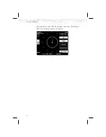
The Chart View Function is accessed by pressing the
FN
Function key and selecting the Chart View (
CHART
)
function.
The Chart View Function incorporates five menu items
that control two basic operations:
·
Selecting a chart
(for static viewing)
·
Loading a chart
(for map overlay)
The term “Selecting a chart” is used to designate that a
given chart is selected for static viewing on the screen.
This is typically done by first specifying the airport, then
the specific chart for that airport.
The term “Loading a chart” is used to designate that a
given chart is loaded for flight operations and can be used
as an actual overlay on the maps. Loading a chart through
the Chart View Function is identical to loading a chart
from the Custom/IFR map as described in previous
sections.
All charts within the database, geo-referenced or not, can
be statically viewed from the Chart View Function. Only
geo-referenced charts can be loaded for map overlay
purposes.
The Chart View Function will retain the last view set and
will not change the chart, zoom level, or pan setting when
the function is exited and re-entered, allowing it to
operate similar to a physical chart manual. An exception
to this is when a chart is loaded in the Custom or IFR
Map functions. When this is done, the loaded chart is set
as the currently selected chart in the Chart View function.
93
Detailed Operation

