A small up or down arrow next to the identifier indicates
that the traffic is climbing or descending at a rate of at
least 500 feet per minute. The end of the vector line that
extends beyond the point of the traffic arrow indicates
where it will be at the end of the selected time interval.
The currently selected time interval is indicated in the
upper left corner of the display.
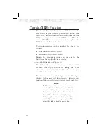
TIS-B Traffic
Traffic Information Service – Broadcast (TIS-B) is
supported by displaying non ADS-B equipped aircraft
that are received over the UAT data link radio.
Non
ADS-B equipped aircraft that are detected by ground
based radar can be up-linked to all aircraft in the area that
are UAT data link equipped.
As TIS target location is determined by ground based
radar, coverage, range and target positional accuracy are
highly dependent on relative location to the actual radar
site. See page 59 for information on TIS-A.
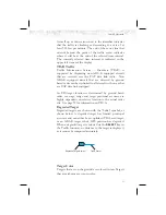
Degraded Target
Degraded targets are shown with the “bullet” symbol, as
shown below. A degraded target has limited positional
accuracy and can either be an uplinked TIS-based target,
or an ADS-B target who’s GPS position has degraded.
When a degraded target is selected via the
SELECT
key in
the Traffic function, no distance to the target is displayed,
as it cannot be computed accurately.
Target Color
Targets that are on the ground are colored in tan. Targets
that are airborne are cyan in color.
51
Detailed Operation
Degraded Target Symbol
Traffic Vector


