

iSXblue/SXBlue II GNSS Series Technical Reference Manual
163
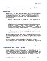
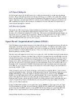
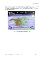
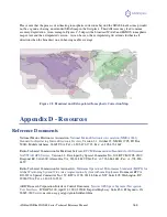
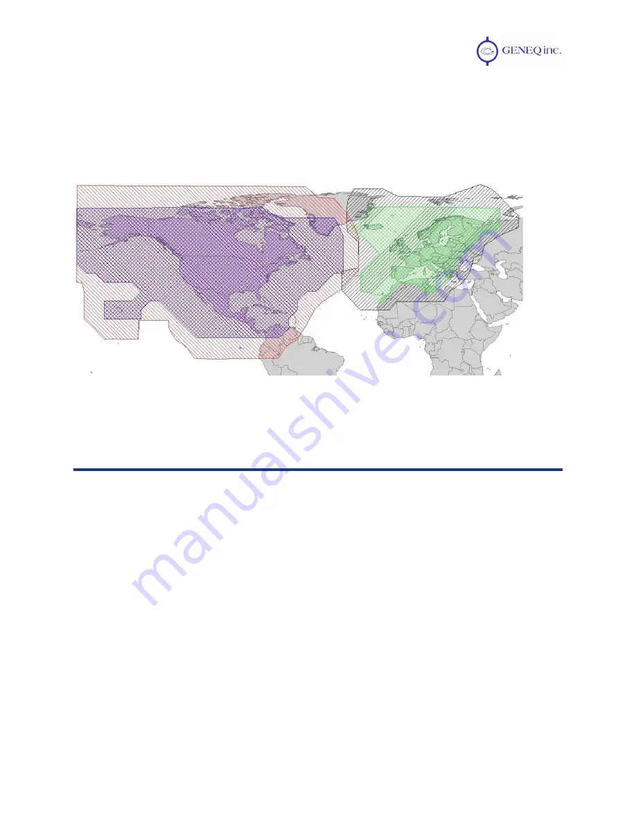
Please note that the process of estimating ionospheric corrections beyond the SBAS broadcast map would
not be as good as having an extended SBAS map in the first place. This difference may lead to minor
accuracy degradation. As an example, Figures C-5 depicts the broadcast WAAS and EGNOS ionospheric
map extent and the extrapolated version. As can be seen, the extrapolated grid extends further in all
directions than the broadcast one, enhancing usable coverage.
Figure C-5 Broadcast and Extrapolated Ionospheric Correction Map
Appendix D - Resources
Reference Documents
National Marine Electronics Association,
National Marine Electronics Association (NMEA 0183)
Standard for Interfacing Marine Electronic Devices
, Version 2.1, October 15, NMEA 1995, PO Box
50040, Mobile Alabama, 36605 USA, Tel: +1-205-473-1793, Fax: +1-205-473-1669
Radio Technical Commission for Maritime Services,
RTCM Recommended Standards for Differential
NAVSTAR GPS Service
, Version 2.2, Developed by Special Committee No. 104, RTCM 1998, 1800
Diagonal Rd, Suite 600, Alexandria, VA, 22314-2840 USA, Tel: +1-703-684-4481, Fax: +1-703-836-
4429
Radio Technical Commission for Aeronautics,
Minimum Operational Performance Standards (MOPS) for
Global Positioning System/Wide Area Augmentation System Airborne Equipment
, Document RTCA
DO-229A, Special Committee No. 159, RTCA 1998, 1828 L Street, NW, Suite 805, Washington, DC,
20036 USA, Tel: +1-202-833-9339
ARIC Research Corporation, Interface Control Document,
Navstar GPS Space Segment / Navigation
User Interfaces
, ICD-GPS-200, April 12, 2000, 2250 E. Imperial Highway, Suite 450, El Segundo, CA
90245-3509, www.navcen.uscg.gov/gps/geninfo/default.htm


