iSXblue/SXBlue II GNSS Series Technical Reference Manual
40
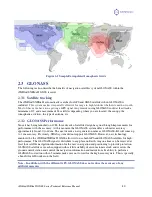
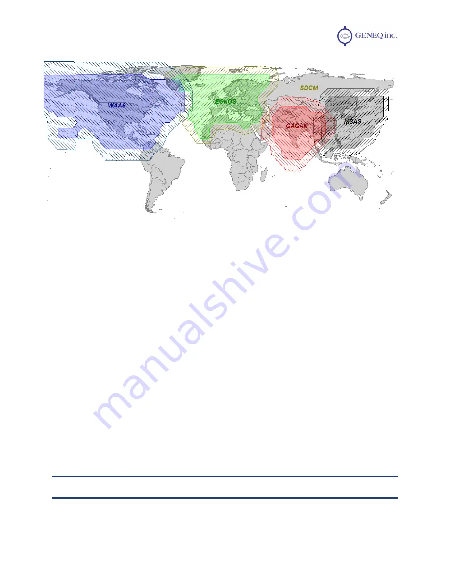
Figure 2-1 Sample Extrapolated Ionospheric Grids
2.3
GLONASS
The following section describe the benefits of navigation satellites system GLONASS within the
iSXBlue/SXBlue II GNSS receiver.
2.3.1
Satellite tracking
The iSXBlue/SXBlue II automatically searches for GPS and GNSS satellites when GLONASS is
included.
This system makes it especially effective for usage in high latitudes whether its north or south.
Most of these area have issue getting a
GPS
signal.
Any receiver using GLONASS could at least track a
minimum of 15 and a maximum of 24 satellites depending where you are located, the canopy, the
ionospheric activities, the type of antenna, etc.
2.3.2
GLONASS Performance
Since it has being launched on 1982, three decade of satellite design has gone through improvements for
performance with the accuracy, At this moment, the GLONASS system offer a submeter accuracy
approximately from 30 to 60 cm. The next decade a new generation name as GLONASS-K2 will come up
to 1 cm accuracy. Previously, SBAS system did not support GLONASS. However, new technology
employed by the iSXBlue/SXBlue II GNSS allows it to use both GPS and GLONASS satellites for high-
performance. The GLONASS signal is distribute to any place on Earth. Any one time can be received at
least four satellite navigation information for the user's navigation and positioning to provide protection.
GLONASS satellites are each equipped with satellite stability of cesium atomic clock, and receives the
ground control station and control the navigation information and instructions Its ability to perform a
GLONASS correction within 2 minutes make user not to wait for the high accuracy data. This is specially
a benefit for GIS worker on the field
.
Note –
In addition, with the different GPS, GLONASS does not reduce the accuracy of any
artificial measures.

