SXBlue GPS Reference Manual
85
Provided that a GPS satellite is available to the SBAS reference station network for
tracking purposes, orbit and timing error corrections will be available for that satellite.
Ionospheric corrections for that satellite are only available if the signal passes through
the ionospheric map provided by SBAS (for example, the WAAS ionospheric map covers
the majority of North America). As an example, if a satellite is South of your current
location at a low elevation angle, the pierce point of the ionosphere will be considerably
South of your location since the ionosphere is at an altitude of approximately 60 km.
There must be sufficient ionospheric map coverage beyond your location in order to
have ionospheric correctors for all satellites.
To enhance the information provided by SBAS, the SXBlue GPS extrapolates the
ionospheric information beyond the broadcast information. This increases the usable
geography for WAAS. This feature helps to improve the usable coverage area of a
SBAS service.
Signal Information
A SBAS transmits correction data on the same frequency as GPS from a geostationary
satellite (the space segment), allowing the use of the same receiver equipment used for
GPS. Another advantage of having SBAS transmit on the same frequency is that only
one antenna is required.
Reception
Since SBAS broadcast in the L-band, the signal requires a line of sight in the same
manner as GPS to maintain signal acquisition.
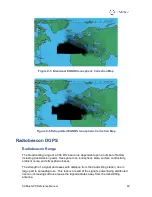
Currently, two commercial marine communication satellites are transmitting WAAS data
for public use, and one each is located above both the Pacific Ocean and Northern
Brazil. Due to their location, these satellites may appear lower on the horizon,
depending on your geographic position on land. In regions where the satellites appear
lower on the horizon, they may be more prone to being masked by terrain, foliage,
buildings or objects, resulting in signal loss. The further that you are away from the
equator and the satellite’s longitude will cause the satellite to appear lower on the
horizon. Fortunately, the COAST Technology helps alleviate this problem by
maintaining system performance when WAAS (SBAS) signal loss occurs for extended
periods of time. More information on COAST is provided in Section 2.3.
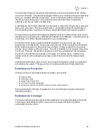
The EGNOS System Test Bed (ESTB), also referred to as EGNOS in this document,
uses two geostationary satellites (separate from WAAS), however, in this case, they are
located over the Atlantic and Indian Oceans. Similar to WAAS, the satellites may appear
lower on the horizon, depending on your geographic position on land. The further that
you are away from the equator and the satellite’s longitude will cause the satellite to
appear lower on the horizon. If the EGNOS signal becomes unavailable due to
obstruction, COAST technology helps to maintain system performance during times of
differential outage.
When using SBAS correction data, the SXBlue GPS is able to provide you with the
azimuth and elevation of the SBAS available satellites via a NMEA serial port command
to aid in determining their position with respect to the built-in antenna. More about this
feature is described in Section 5.2.5.

