Section 3 Display Symbology
1
st
Ed Nov 2018
IDU-450 EFIS Software Version 8.0H (Rotorcraft)
3-65
NOTE:
Since a suppressed waypoint is not part of the active flight plan, dashes
appear in the absence of the following VNAV data associated with a
suppressed waypoint:
1) Path data (dashes)
2) Distance data (dashes)
3) ETE data (dashes)
4) ETA data (dashes)
5) Fuel remaining data
(dashes)
3.7.
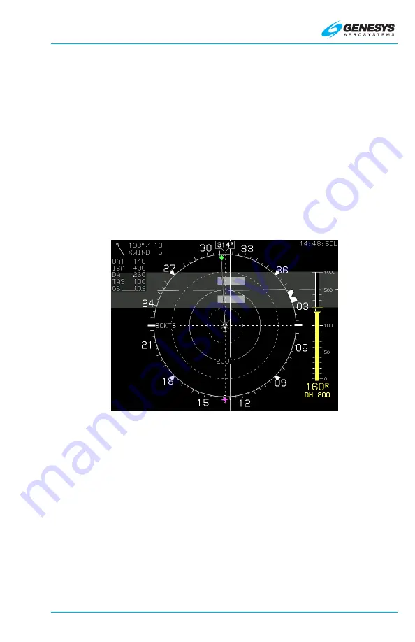
Hover Page
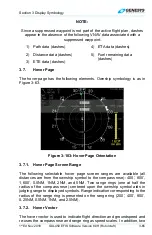
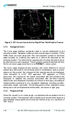
The hover page has the following elements. Ownship symbology is as in
Figure 3-63.
Figure 3-103: Hover Page Orientation
3.7.1. Hover Page Screen Range
The following selectable hover page screen ranges are available (all
distances are from the ownship symbol to the compass rose): 400’, 800’,
1,600’, 0.5NM, 1NM, 2NM, and 5NM. Two range rings (one at half the
radius of the compass rose) centered upon the ownship symbol aids in
judging range to displayed symbols. Range indication corresponding to the
radius of the range ring is presented on the range ring (200’, 400’, 800’,
0.25NM, 0.5NM, 1NM, and 2.5NM).
3.7.2. Hover Vector
The hover vector is used to indicate flight direction and groundspeed and
re-uses the compass rose and range ring as speed scales. In addition, two

