737 MAX Flight Crew Operations Manual
Flight Instruments, Displays -
MAX Display System - Displays
MN-FLT-OH-201
10.10.31
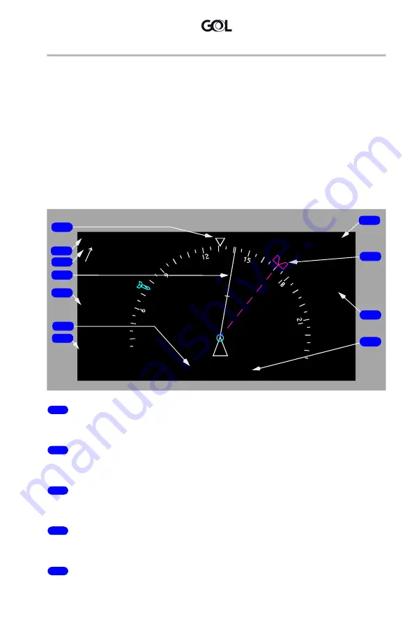
Part-Time Mini-Map Display
The large display units allow for the compass rose to become a part-time
mini-MAP. The part-time mini-MAP is only available when the normal PFD and
AUX are displayed and the onside ND is not displayed due to an inboard display
failure.
The part-time mini-MAP, a condensed version of the ND MAP is at a fixed 20 nm
range and is meant to be a short-term navigational display which allows the pilots
to see their relationship to the flight plan and potential threats ahead. TCAS targets
and terrain/weather can be displayed on the mini-MAP. Terrain, TCAS and
Predictive Windshear alerts are annunciated on the mini-MAP. True Airspeed
(TAS), Ground Speed (GS), Wind Direction, and Wind Speed are also shown.
1
Current Heading Pointer (white)
Indicates current heading.
2
Groundspeed/True Airspeed (white)
Indicates current groundspeed and true airspeed.
3
Wind Direction/Speed/Arrow (magenta)
Indicates current wind direction and wind speed
4
Track Pointer (white)
Indicates current track.
5
Terrain/Weather Radar Annunciations (cyan)
Annunciates TERR is selected and displays associated Peaks Mode data.
SEL HDG
MAG
170
10
VOR 1
116.00
121
DME
GS
341
o
/ 15
482
TAS
475
TERR
32.5
GRH
0838.4
Z
NM
TFC
TA ONLY
OFFSCALE
TRAFFIC
OBSTACLE
WINDSHEAR
KBFI
A
ADF 2
KXYZ
11
9
6
1
4
3
5
7
8
10
2
March 1, 2021


