Geophysical Survey Systems, Inc.
UtilityScan with GS Software
Manual
MN71-307 Rev B
1
Introduction
Thank you for purchasing the GSSI UtilityScan
®
(Panasonic G2 Tablet). GSSI is re-imagining the
standard in underground utility locating by pairing cutting-edge sensors with a powerful Windows-based
user interface to create a high-performance product at an affordable cost. The UtilityScan is designed with
today’s busy subsurface professional in mind. It’s a tool that packs a ton of simple-to-learn functionality
into a ruggedly reliable package.
What Comes in the Box
•
UtilityScan system, pre-assembled
•
Panasonic G2 control tablet
•
Two (2) rechargeable lithium ion UtilityScan batteries with charger
•
Ethernet cable (2 meters long)
•
AC power adaptor and set of international plugs for the tablet
•
AC power supply for charging the tablet
•
USB drive for data transfer
•
Mount for the Tablet
•
Sunshade
•
UtilityScan Panasonic G2 Quick Start Guide
A Note about HyperStacking
®
Technology
The GPR data displayed on your UtilityScan starts as received pulses of electromagnetic energy that have
reflected off objects or interfaces in the ground. The reflected signals generate electrical charges in the
receive antenna element that are digitized by the antenna’s onboard sampler. They are then converted into
digital values and displayed as a colorized linescan profile or an oscilloscope trace. Traditional GPR
systems send out one pulse at a time and record one small piece of reflected information (a sample) from
that one pulse. It takes many samples to make a single scan and many scans to make a reflection profile.
HyperStacking (HS for short) technology represents a generational leap in GPR. HS antennas record
many samples from a single pulse. This allows an HS antenna to record data at speeds up to an order of
magnitude faster than conventional systems. In practice, the HS antennas use that extra data to average, or
stack, individual samples. This helps to reduce the random noise present in the signal and results in
cleaner and deeper data.
An added benefit is that we randomize the timing of the transmit pulse. This is called “dithering” and
means that we automatically average out manmade noise from nearby radio transmitters. This patented
technique enables you to work more confidently in high-noise environments like urban areas or airports.
About this Manual
This document provides important information for operating the UtilityScan (Panasonic G2) and
collecting, reviewing, and transferring GPR data to a PC. It is available for free download at
. This manual is not necessarily a substitute for a full training class. Purchase of a
UtilityScan system includes complimentary access to GSSI’s regularly scheduled curriculum of
professionally led training classes. We encourage you to take advantage of the opportunities for
instruction and networking with other professionals. Please visit
Summary of Contents for UtilityScan 50350HS
Page 1: ...MN27 151 Rev A MN71 307 Rev B ...
Page 4: ...Geophysical Survey Systems Inc UtilityScan with GS Software Manual ...
Page 6: ...Geophysical Survey Systems Inc UtilityScan with GS Software Manual ...
Page 8: ...Geophysical Survey Systems Inc UtilityScan with GS Software Manual MN71 307 Rev B 2 ...
Page 14: ...Geophysical Survey Systems Inc UtilityScan with GS Software Manual MN71 307 Rev B 8 ...
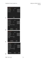
Page 20: ...Geophysical Survey Systems Inc UtilityScan with GS Software Manual MN71 307 Rev B 14 1 2 3 4 ...
Page 46: ...Geophysical Survey Systems Inc UtilityScan with GS Software Manual MN71 307 Rev B 40 ...
Page 47: ...Geophysical Survey Systems Inc UtilityScan with GS Software Manual MN71 307 Rev B 41 ...


