Guilin Feiyu Electronic Technology Co.,Ltd
Guilin Feiyu Electronic Technology Co.,Ltd http://www.feiyudz.cn Tel:0773-5815749
25
Electronic map display the current location, flight course, the current target route, flight tracks,
flight plan objectives and target destinations of the user’s aircraft
Red Plane Icon:
The current aircraft’s position and heading;
Blue Dotted Line:
Aircraft flew over the track.
Virtual Red Line:
The current target route.
Hollow Double Green Line:
The planned target route.
Red Flag Icon:
The planned target destination.
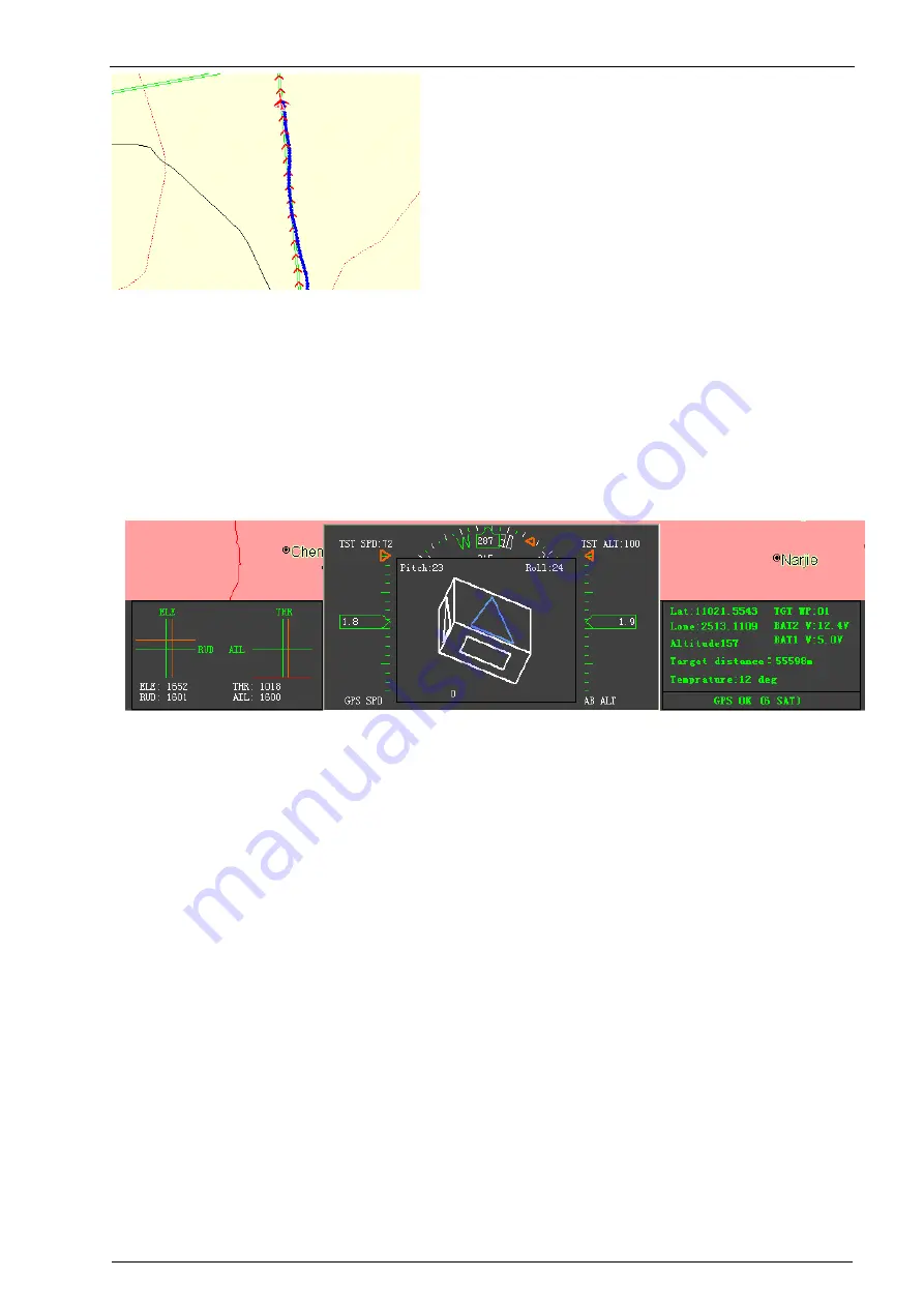
7. Meter Bar:
Graphical instrument is divided into six meters; the topside is the map scale. The upper left is
output meter to monitor the servo output; the lower left is the character display data sheet.
Followed by the middle of the table are GPS speed, flight attitude instrument, and pressure
altimeter. The above is the heading table. The green triangle indicates data on the speedometer, the
altimeter, as well as the heading table is the current value, the orange hollow triangle indicates data
is the target value.
Flight Attitude Instrument:
Displaying the pitch angle, roll angle, unit and degree of the current
aircraft.
GPS Speed
:
GPS measures the relative velocity, the unit and km/h between the aircraft and
ground.
Barometric altitude:
Baroceptor measures the altitude difference between the aircraft and take-
off location .unit: meter.
Heading Table:
The figures inside the dial represent the tens digit, for example, dial "3" represents
the 30 degrees, dial "33" represents 330 degrees. N for True North, S for true south, E for true east,
W is true west. Solid triangle indicates data means the current course, orange hollow
double-triangular data means the current goal course.
8. Air Route and Navigation Parameter Setting:
Status and Control Display Columns:
Green color means the current mode is open.
Master switch:


