background image

-

118

-


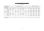
Nonlinear Reflectivity Mapping 2# (Continued on the Next Page)


Reflectivity Index 

(0~255)


Reflectivity


(%)


Reflectivity Index 

(0~255)


Reflectivity


(%)


Reflectivity Index 

(0~255)


Reflectivity


(%)


Reflectivity Index 

(0~255)


Reflectivity


(%)


160


102.65


180


151.8


200


151.8


220


200.95


161


102.65


181


151.8


201


151.8


221


200.95


162


102.65


182


151.8


202


151.8


222


200.95


163


151.8


183


151.8


203


151.8


223


200.95


164


151.8


184


151.8


204


151.8


224


200.95


165


151.8


185


151.8


205


151.8


225


200.95


166


151.8


186


151.8


206


151.8


226


200.95


167


151.8


187


151.8


207


200.95


227


200.95


168


151.8


188


151.8


208


200.95


228


200.95


169


151.8


189


151.8


209


200.95


229


200.95


170


151.8


190


151.8


210


200.95


230


200.95


171


151.8


191


151.8


211


200.95


231


200.95


172


151.8


192


151.8


212


200.95


232


200.95


173


151.8


193


151.8


213


200.95


233


200.95


174


151.8


194


151.8


214


200.95


234


200.95


175


151.8


195


151.8


215


200.95


235


200.95


176


151.8


196


151.8


216


200.95


236


200.95


177


151.8


197


151.8


217


200.95


237


200.95


178


151.8


198


151.8


218


200.95


238


200.95


179


151.8


199


151.8


219


200.95


239


200.95


Summary of Contents for Pandar128E3X

Page 1: ...www hesaitech com HESAI Wechat Pandar128E3X 128 Channel Mechanical LiDAR User Manual...

Page 2: ...FOV 51 4 4 High Resolution 53 4 5 Operation Statistics 54 4 6 Monitor 55 4 7 Upgrade 56 4 8 Log 57 4 9 Security 58 4 10 Login 63 4 11 Cybersecurity Configuration 64 5 PandarView 72 5 1 Installation 7...

Page 3: ...tampered with and must not be changed in any way There are no user serviceable parts inside the product For repairs and maintenance inquiries please contact an authorized Hesai Technology service prov...

Page 4: ...imal performance do not touch the product s cover lens with bare hands If the cover lens is already stained please refer to the cleaning method in the Sensor Maintenance chapter of user manuals Eye Sa...

Page 5: ...Some components in the product can emit electromagnetic fields which may interfere with medical devices such as cochlear implants heart pacemakers and defibrillators Consult your physician and medical...

Page 6: ...nciple Distance Measurement Time of Flight ToF 1 A laser diode emits a beam of ultrashort laser pulses onto the target object 2 The laser pulses are diffusely reflected after hitting the target object...

Page 7: ...s illustrated in Figure 1 3 Z axis is the axis of rotation By default the LiDAR rotates clockwise in the top view To select counterclockwise rotation see Section 4 2 Web Control Settings The origin is...

Page 8: ...ure 1 5 Channel Vertical Distribution Figure 1 6 Laser Firing Position Unit mm Each channel has an intrinsic angle offset both horizontally and vertically The offsetted angles are recorded in this LiD...

Page 9: ...Laser Product CE UKCA MECHANICAL ELECTRICAL OPERATIONAL Wavelength 905 nm Laser Class Class 1 Eye Safe Ingress Protection IP6K7 IP6K9K Dimensions Height 123 7 mm Top Bottom 118 0 116 0 mm Rated Volta...

Page 10: ...lity Measured under 100 klux ambient intensity Range Accuracy May vary with range temperature and target reflectivity The range capability and horizontal resolution of each channel is shown in Appendi...

Page 11: ...9 2 Setup 2 1 Mechanical Installation Figure 2 1 Front View Unit mm...

Page 12: ...10 Figure 2 2 Bottom View Unit mm...

Page 13: ...11 Quick Installation Figure 2 3 Quick Installation...

Page 14: ...12 Stable Installation Figure 2 4 Stable Installation...

Page 15: ...13 2 2 Interfaces Lemo part number EEG 2T 316 CLN female socket on the LiDAR Looking from the bottom of the LiDAR Figure 2 5 Lemo Connector Female Socket...

Page 16: ...to 1 V 13 Ethernet BI_DD 1 to 1 V 6 Ethernet BI_DB 1 to 1 V 14 Ethernet BI_DD 1 to 1 V 7 Ethernet BI_DA 1 to 1 V 15 Index 0 to 3 3 V 8 Ethernet BI_DA 1 to 1 V 16 Encoder 0 to 3 3 V Automotive 1000Base...

Page 17: ...r disconnecting an external GPS signal either using the cable s GPS wire or via the connection box s GPS port make sure the LiDAR is powered off If the LiDAR has to stay powered on make sure to ground...

Page 18: ...cables or the shells or by twisting the connectors in any way Doing so can loosen the connectors shells or even damage the contacts In case a connector s shell is accidentally pulled off stop using t...

Page 19: ...may connect the LiDAR directly or using the connection box The connection box has a power port a GPS port and a standard Ethernet port Lemo part number FSG 2T 316 CLAC80Z male plug on the connection...

Page 20: ...t BI_DB 1 to 1 V Green White 14 Ethernet BI_DD 1 to 1 V Brown White 7 Ethernet BI_DA 1 to 1 V Orange 15 Index 0 to 3 3 V Gray 8 Ethernet BI_DA 1 to 1 V Orange White 16 Encoder 0 to 3 3 V Gray White Au...

Page 21: ...T SHR 06V S B Voltage standard RS232 Baud rate 9600 bps The GPS port pin numbers are 1 to 6 from left to right defined as follows Pin Direction Pin Description Requirements 1 Input PPS pulse per secon...

Page 22: ...3 3 V Signal type pulse Max current output level 12 mA Pin Description for the trigger port Pin Direction Pin Description 1 Input GND to ground the external trigger signal 2 Output Encoder Trigger sig...

Page 23: ...21 2 3 2 Connection Figure 2 10 Connection Box Connection NOTE Refer to Appendix III PTP Protocol when PTP is used...

Page 24: ...al Ethernet port name Open the Network Sharing Center click on Ethernet In the Ethernet Status box click on Properties Double click on Internet Protocol Version 4 TCP IPv4 Configure the IP address to...

Page 25: ...ecurity field 32 bytes in Point Cloud UDP Data is present only when point cloud signature is enabled Figure 3 1 Data Structure LiDAR Data Point Cloud Data Packet 935 bytes Ethernet Header 42 bytes UDP...

Page 26: ...C 12 Destination broadcast 0xFF 0xFF 0xFF 0xFF 0xFF 0xFF Source xx xx xx xx xx xx Ethernet Data Packet Type 2 0x08 0x00 Internet Protocol 20 Shown in the figure below UDP Port Number 4 UDP source port...

Page 27: ...P start of packet 0xFF 1 SOP start of packet Protocol Version Major 1 To distinguish between product models 0x01 for the Pandar128E3 series Protocol Version Minor 1 For each product model to indicate...

Page 28: ...k Return 1 Reserved Dis Unit 1 0x04 4 mm Return Num 1 0x02 each channel can generate two returns maximum Flags 1 7 5 is reserved 4 0 shows whether this data packet contains the following information 4...

Page 29: ...field to target reflectivity can be selected in Section 4 2 Web Control Settings Three single return modes and three dual return modes are available see the Return Mode field in the Tail of Point Clo...

Page 30: ...stance 0 3 to 2 85 m near field measurement range The current channel is not a NF near field enabled channel see Appendix I Channel Distribution Therefore no valid point cloud output Distance 3 Return...

Page 31: ...ng Counter 2 0 indicates whether the fault reporting system gets stuck Starting from 0 the rolling counter increments by 1 every time the fault message is updated Normally the fault message is updated...

Page 32: ...e 0 3 High Performance mode 0 1 Standard mode Energy Saving mode 11 0 is reserved Operational State 1 0 High Performance i e High Resolution 1 Shutdown 2 Standard 3 Energy Saving reduced range capabil...

Page 33: ...he second Each Byte Range Decimal Year current year minus 1900 Positive integers Month 1 to 12 Day 1 to 31 Hour 0 to 23 Minute 0 to 59 Second 0 to 59 Timestamp 4 The s time part of the absolute time o...

Page 34: ...Conversion factor of angular velocity as an unsigned integer Currently 14000 0x36B0 Unit of angular velocity 0 01 mdps 14000 140 mdps millidegree per second IMU Timestamp 4 Timestamp of the IMU data...

Page 35: ...ar velocity 5 140 mdps 700 mdps IMU Y Axis Angular Velocity 2 Angular velocity of the Y axis IMU Z Axis Angular Velocity 2 Angular velocity of the Z axis CRC 3 4 CRC 32 checksum of the Tail Cyber Secu...

Page 36: ...angle current reference angle of the rotor horizontal angle offset firing time angular offset Current reference angle of the rotor is the Azimuth field of Block 2 Horizontal angle offset 1 093 for Cha...

Page 37: ...35 Continued Draw the data point in a polar or rectangular coordinate system Obtain the real time point cloud data by analyzing and drawing every data point in each frame...

Page 38: ...cket Meanwhile the LiDAR will extract the actual date and time from NMEA messages GPRMC or GPGGA and stamp them into both Point Cloud Data Packets and GPS Data Packets Point Cloud Data Packets 6 byte...

Page 39: ...roadcast 0xFF 0xFF 0xFF 0xFF 0xFF 0xFF Source xx xx xx xx xx xx Ethernet Data Packet Type 2 0x08 0x00 Internet Protocol 20 Shown in the figure below UDP Port Number 4 UDP source port 0x2710 represents...

Page 40: ...MEA sentence that contains date and time ASCII code valid till 2 bytes after the asterisk The LiDAR can receive either GPRMC or GPGGA see Chapter 4 Web Control Settings Reserved 404 404 bytes of 0xDF...

Page 41: ...hex 0 for GPS being unlocked 09 UTC Date Date information Typically in ddmmyy day month year format The LiDAR s GPS data interface is compatible with a variety of GPRMC formats as long as 01 is the h...

Page 42: ...lid 1 GPS fix SPS 2 DGPS fix 3 PPS fix 6 estimated dead reckoning The LiDAR s GPS data interface is compatible with a variety of GPGGA formats as long as 01 is the hour minute and second information F...

Page 43: ...0x32 0 2 20 Month 0x34 0x30 4 0 04 Day 0x37 0x30 7 0 07 Time Field Data ASCII Code Characters Meaning Second 0x38 0x35 8 5 58 Minute 0x37 0x30 7 0 07 Hour 0x34 0x30 4 0 04 s Time 4 bytes in units of...

Page 44: ...vice info and upgrading To access web control 1 Connect the LiDAR to your PC using an Ethernet cable 2 Set the IP address according to Section 2 4 Get Ready to Use 3 Enter this URL into your web brows...

Page 45: ...ssage PTP Status Free Run No PTP master selected Tracking Slave is trying to sync with the selected PTP Master but the absolute offset is over 1 s Locked Absolute offset between Slave and Master is 1...

Page 46: ...control will be reset to factory defaults The default values are shown in the screenshots in Section 4 2 Settings Section 4 3 1 Azimuth FOV for All Channels Section 4 4 High Resolution 2 Control IP V...

Page 47: ...ct Master and click Save at the bottom of the Settings page Connection to web control will be lost Then connect the LiDAR directly to a Slave host Connection box is not supported 3 Destination IP Mode...

Page 48: ...Noise Filtering Mitigation of noise points Interstitial Points Filtering Interstitial point when a beam partially hits on a front target s edge and further hits on a rear target the return signal can...

Page 49: ...four states according to ambient temperature High Performance Standard Energy Saving and Shutdown See table below Constant shifting only between High Performance and Shutdown Standby Mode In Operation...

Page 50: ...ode LiDARs do not output GPS Data Packets see Appendix III PTP Protocol When GPS is selected as the clock source GPS Mode GPRMC GPGGA Format of the NMEA data received from the external GPS module see...

Page 51: ...f the absolute offset between Slave and Master when the LiDAR is in PTP Locked status See Section 4 1 Home Switch Type TSN Non TSN Under 802 1AS or 802 1AS Automotive profile TSN Time Sensitive Networ...

Page 52: ...l 2 to 3 log seconds Time interval between Announce messages default 1 PTP logSyncInterval 7 to 3 log seconds Time interval between Sync messages default 1 PTP logMinDelayReq Interval 7 to 3 log secon...

Page 53: ...select one of the two modes for all channels or multi section FOV 4 3 1 For all channels A continuous angle range specified by a Start Angle and an End Angle will be applied to all channels The LiDAR...

Page 54: ...its specified range 4 3 3 Note Click Save to apply your settings The angles in degrees are accurate to the first decimal place If the Start Angle is larger than the End Angle then the actual azimuth F...

Page 55: ...all channels High Resolution 10 Hz 0 1 for the 64 high res channels Channel 26 to Channel 89 0 2 for the other channels NOTE Channel counts from 1 to 128 20 Hz 0 2 for the 64 high res channels Channe...

Page 56: ...54 4 5 Operation Statistics The LiDAR s operation time in aggregate and in different temperature ranges are listed as well as the internal temperature and humidity...

Page 57: ...55 4 6 Monitor The LiDAR s input current voltage and power consumption are displayed...

Page 58: ...pload button select an upgrade file and confirm your choice in the pop up window When the upgrade is complete the LiDAR will automatically reboot and the past versions will be logged in the Upgrade Lo...

Page 59: ...sed for software troubleshooting pandar_control the LiDAR s control program diag_ff functional safety diagnosis program errors exceptions that may affect the LiDAR s normal operation warnings exceptio...

Page 60: ...58 4 9 Security Cyber Security Master Switch OFF Cyber Security Master Switch ON...

Page 61: ...Connection OFF Use PTC and HTTP cleartext protocols ON Use PTCS and HTTPS encrypted protocols Point Cloud Signature Users can change the shared secret key NOTE The activation deactivation of point cl...

Page 62: ...30 characters containing at least one digit and one letter case sensitive special characters are allowed Confirm New Password Input the new password again and click Save In case the password is forgo...

Page 63: ...only the user authenticates the LiDAR mTLS two way auth mode the user and the LiDAR authenticate each other mTLS is recommended to enhance security see Section 4 11 2 mTLS Click Upload and select a u...

Page 64: ...62 3 Point Cloud Signature Shared Secret Key 8 to 32 digits or letters case sensitive Used for negotiating a session key see Section 4 11 3 Cybersecurity Config Point Cloud Signature...

Page 65: ...n the Security page is ON https 192 168 1 201 redirects to the Login page Username fixed admin Default password 123456 To effectively implement login control please change the default password see Sec...

Page 66: ...re your TLS version is 1 3 or above with OpenSSL 1 1 1 or above Firewall port exceptions Port 9347 PTC PTCS Port 80 HTTP Port 443 HTTPS and Ports 319 and 320 PTP 1588v2 An entity certificate is saved...

Page 67: ...ised of the above root and intermediate certificates NOTE In case you need to obtain the CA certificates again contact a sales representative or technical support engineer from Hesai Below are the ste...

Page 68: ...66 1 Go to the Settings Options Preference page of your browser Input Certificate in the search bar Select Manage View Certificates...

Page 69: ...e intermediate certificate under the former tab and upload the root certificate under the latter tab If only one tab is named Authorities see right hand screenshot click Import to upload the intermedi...

Page 70: ...68 In case the following warnings appear select Trust this CA to identify websites...

Page 71: ...69 3 When the import is complete the CA certificate appears in the dialog box Double click to see detailed information...

Page 72: ...ure your user certificate is always valid with or without an external clock source the start date of the validity period should be 2019 01 01 or an earlier date the expiry date should be later than th...

Page 73: ...gain The process of signature generation shown in the flowchart below The client and the LiDAR negotiate and exchange random numbers which are used for calculating a session key The session key is use...

Page 74: ...m Installation Files Installation Steps Windows PandarViewX64_Release_V1 7 42 msi Before upgrading PandarView to a newer version please uninstall the current version Double click and install PandarVie...

Page 75: ...ck the CA CRT button see screenshot below and specify the file path of Hesai s CA certificate chain Hesai_Ca_Chain crt mTLS Mode On the Security page of web control turn ON the Cyber Security Master S...

Page 76: ...curity Master Switch In PandarView s PTC drop down menu see screenshot below select PTC Thus PandarView automatically retrieves the LiDAR unit s calibration file using PTC commands 5 2 2 Receive Live...

Page 77: ...75 5 3 Record Point Cloud Data 1 Click on to pop up the Choose Output File window 2 Specify the file directory and click on Save to begin recording a PCAP file 3 Click on again to stop recording...

Page 78: ...CSV see Section 1 3 Channel Distribution We recommend importing the calibration file of this LiDAR unit into PandarView File Import Correction File in order to display the point cloud most accurately...

Page 79: ...e paused jump to the next frame While playing forward May click again to adjust the forward speed 2x 3x 1 2x 1 4x and 1x Jump to the end of the file Save a single frame to CSV While playing this Recor...

Page 80: ...t of view The bottom left coordinate axes show the current point of view 3D Projection and Distance Measurement PandarView supports perspective projection default and orthographic projection The dista...

Page 81: ...blocks in Section 3 1 2 Point Cloud UDP Data UDP Port Enter the UDP port number and click Set View Filter To set the polar rectangular coordinate range for viewing live point cloud data or a PCAP fil...

Page 82: ...erence Circles Click on to show hide the 12 distance reference circles The actual distances are marked below To change the color and line width of these circles click on Tools in the menu bar and open...

Page 83: ...cts Channel Selection Click on to open the Channel Selection box Check Uncheck the boxes on the left to show hide each channel By default the point cloud data from all channels are shown Check Uncheck...

Page 84: ...e data of the highlighted points as shown below Some of the data fields are defined below Field Description points The XYZ coordinates of each point azimuth Rotor s current reference angle azimuth_cal...

Page 85: ...olor legend at the lower right corner The default color scheme is intensity based Users can choose from other colors schemes based on azimuth azimuth_calib distance elevation laser_id or timestamp Cli...

Page 86: ...ical support LiDAR models that support cybersecurity can communicate using the encrypted PTCS PTC over TLS and HTTPS HTTP over TLS API Data format is the same with the cleartext PTC HTTP API The sampl...

Page 87: ...rt fingerprints and oil can negatively affect point cloud data quality Please perform the following steps to remove the stains NOTE To avoid damaging the optical coating DO NOT apply pressure when wip...

Page 88: ...lation and keep away from fire Solvent temperature 20 to 25 4 When the stains have loosened dip a piece of lint free wipe into the solvent made in Step 3 and gently wipe the cover lens back and forth...

Page 89: ...uirements in Section 1 4 Specifications and 2 3 Connection Box web control can be accessed see cannot open web control on the next page Power on again to check if the symptom persists Motor is running...

Page 90: ...C s Users may use WireShark to check the LiDAR s IP that broadcasts data packets Afterwards restart PC or connect the LiDAR to another PC power on again to check if the symptom persists Abnormal packe...

Page 91: ...on Statistics page of web control Afterwards check for packet loss If no packet is missing while the point cloud flashes please update PandarView to the latest version see the Download page of Hesai s...

Page 92: ...re laser pulses that measure the far field 2 85 m Additionally the NF enabled channels also fire laser pulses that measure only the near field 0 3 2 85 m at a time other than these channels far field...

Page 93: ...06 3 273 11 702 0 3 m 100 m YES 120 m 100 m 6 07 1 094 11 239 2 85 m 100 m 120 m 100 m 6 08 3 278 10 771 2 85 m 100 m 140 m 100 m 3 09 1 095 10 305 0 3 m 100 m YES 140 m 100 m 3 10 3 283 9 830 2 85 m...

Page 94: ...S 27 7 72 1 885 2 85 m 200 m 140 m 200 m 37 YES 28 5 535 1 761 2 85 m 200 m 140 m 200 m 37 YES 29 3 325 1 637 2 85 m 200 m 140 m 200 m 37 YES 30 3 33 1 511 2 85 m 200 m 140 m 200 m 37 YES 31 1 107 1 3...

Page 95: ...YES 47 1 110 0 632 0 3 m 200 m YES 200 m YES 200 m 10 YES 48 5 555 0 760 2 85 m 200 m 200 m YES 200 m 10 YES 49 7 750 0 887 2 85 m 200 m 200 m YES 200 m 10 YES 50 1 119 1 012 2 85 m 200 m 200 m YES 2...

Page 96: ...2 85 m 200 m 140 m 200 m 37 YES 67 7 780 3 172 2 85 m 200 m 140 m 200 m 37 YES 68 5 578 3 299 0 3 m 200 m YES 140 m 200 m 37 YES 69 3 351 3 425 2 85 m 200 m 140 m 200 m 37 YES 70 3 358 3 552 2 85 m 2...

Page 97: ...69 5 589 2 85 m 200 m 140 m 200 m 37 YES 87 1 118 5 718 2 85 m 200 m 140 m 200 m 37 YES 88 5 599 5 843 2 85 m 200 m 140 m 200 m 37 YES 89 7 811 5 968 2 85 m 200 m 140 m 200 m 37 YES 90 1 129 6 100 0 3...

Page 98: ...5 m 100 m 50 m 100 m 120 107 1 135 14 66 2 85 m 100 m 50 m 100 m 120 108 3 410 15 154 0 3 m 100 m YES 50 m 100 m 120 109 1 137 15 645 2 85 m 100 m 50 m 100 m 120 110 3 416 16 135 2 85 m 100 m 50 m 100...

Page 99: ...set Vertical Min Max 121 1 145 21 379 2 85 m 100 m 25 m 100 m 1600 122 3 436 21 848 2 85 m 100 m 25 m 100 m 1600 123 1 146 22 304 0 3 m 100 m YES 25 m 100 m 1600 124 3 440 22 768 2 85 m 100 m 25 m 100...

Page 100: ...e round of firing are stored in the two blocks of one packet The absolute time of a Point Cloud Data Packet is the time when the LiDAR sends a command to trigger a round of firing that will be stored...

Page 101: ...pends on the horizontal resolution whether the LiDAR is operating in High Resolution mode or Standard mode defined in Chapter 4 Web Control High Resolution Block Start Time s in High Resolution Mode S...

Page 102: ...rformance standard energy saving shutdown 2 Check the Azimuth Flag field in the Tail of the Point Cloud Data Packet obtain the azimuth flag of Block m Range in High Performance mode 0 1 2 3 Range in S...

Page 103: ...09 30209 7 6441 6441 0 0 6091 6091 0 0 6441 6441 6091 6091 8 0 0 4786 4786 0 0 4086 4086 32564 32564 31864 31864 9 0 0 6441 7206 0 0 6091 6091 34219 34984 33869 33869 10 776 776 0 0 776 776 0 0 776 77...

Page 104: ...6 12666 12666 12666 29 14951 14951 15301 15301 14951 14951 14601 14601 43079 43079 42379 42379 30 19521 19521 19871 19871 19521 19521 19171 19171 19521 19521 19521 19521 31 19521 19521 19871 19871 195...

Page 105: ...8 10381 10381 10731 10731 10381 10381 10031 10031 38509 38509 37809 37809 49 21806 21806 22156 22156 21806 21806 21456 21456 21806 21806 21806 21806 50 8096 8096 8446 8446 8096 8096 7746 7746 36224 36...

Page 106: ...8 10381 10381 10731 10731 10381 10381 10031 11426 38509 38509 37809 39204 69 24091 24091 24441 24441 24091 24091 23741 23741 52219 52219 51519 51519 70 10381 10381 10731 10731 10381 10381 10031 10031...

Page 107: ...8446 8096 8096 7746 7746 36224 36224 35524 35524 87 12666 12666 13016 13016 12666 12666 12316 12316 12666 12666 12666 12666 88 21806 21806 22156 22156 21806 21806 21456 21456 21806 21806 21806 21806...

Page 108: ...30209 30209 107 0 0 776 776 0 0 776 776 28554 28554 28554 28554 108 0 0 4786 4786 0 0 4086 5331 32564 32564 31864 33109 109 6441 6441 0 0 6091 6091 0 0 6441 6441 6091 6091 110 0 0 6441 6441 0 0 6091 6...

Page 109: ...36 0 0 4436 4436 4436 4436 122 6441 6441 0 0 6091 6091 0 0 6441 6441 6091 6091 123 0 0 6441 6441 0 0 6091 6856 34219 34219 33869 34634 124 0 0 2781 2781 0 0 2431 2431 30559 30559 30209 30209 125 2431...

Page 110: ...PTP Protocol The Precision Time Protocol PTP is used to synchronize clocks across a computer network It can achieve sub microsecond clock accuracy LiDAR Connection When Using PTP Figure III 1 Connecti...

Page 111: ...iDAR does not output GPS Data Packets The timestamps and Date Time fields in Point Cloud Data Packets strictly follow the PTP master device Certain PTP master devices may have a specified offset from...

Page 112: ...to 255 Alternatively users may choose the Nonlinear Mapping mode see Chapter 4 Web Control Settings Nonlinear Mapping 1 This mapping increases the contrast in low reflectivity region The nonlinear re...

Page 113: ...23 0 87 43 3 07 63 6 5 4 0 04 24 0 95 44 3 21 64 6 7 5 0 05 25 1 05 45 3 36 65 6 9 6 0 08 26 1 15 46 3 5 66 7 1 7 0 11 27 1 25 47 3 64 67 7 3 8 0 13 28 1 35 48 3 79 68 7 5 9 0 15 29 1 45 49 3 93 69 7...

Page 114: ...4 24 5 144 32 75 85 11 62 105 17 5 125 24 83 145 33 25 86 11 87 106 17 83 126 25 25 146 33 75 87 12 12 107 18 17 127 25 75 147 34 25 88 12 37 108 18 5 128 26 17 148 34 75 89 12 62 109 18 83 129 26 5 1...

Page 115: ...75 224 79 25 165 43 25 185 54 25 205 66 25 225 79 75 166 43 75 186 54 75 206 66 75 226 80 5 167 44 25 187 55 25 207 67 5 227 81 25 168 44 75 188 55 75 208 68 25 228 81 75 169 45 25 189 56 5 209 68 75...

Page 116: ...ear Reflectivity Mapping 1 Continued Reflectivity Index 0 255 Reflectivity 240 90 5 241 91 5 242 92 5 243 93 25 244 93 75 245 94 5 246 95 5 247 96 25 248 96 75 249 97 5 250 98 5 251 99 5 252 132 253 1...

Page 117: ...he resolution of low reflectivity objects especially lane markings The nonlinear relationship is detailed below Reflectivity Index 0 255 Figure IV 2 Nonlinear Reflectivity Mapping 0 50 100 150 200 250...

Page 118: ...587 25 14 4889 45 21 589 65 41 0414 6 7 2173 26 14 795 46 21 9623 66 42 0728 7 7 6535 27 15 1043 47 22 7185 67 43 117 8 8 3318 28 15 4168 48 23 1014 68 44 174 9 8 8 29 15 7325 49 23 8768 69 45 2438 1...

Page 119: ...86 2358 125 102 65 145 102 65 86 64 7435 106 86 9803 126 102 65 146 102 65 87 66 0373 107 88 4789 127 102 65 147 102 65 88 66 689 108 89 233 128 102 65 148 102 65 89 68 002 109 90 7508 129 102 65 149...

Page 120: ...65 151 8 185 151 8 205 151 8 225 200 95 166 151 8 186 151 8 206 151 8 226 200 95 167 151 8 187 151 8 207 200 95 227 200 95 168 151 8 188 151 8 208 200 95 228 200 95 169 151 8 189 151 8 209 200 95 229...

Page 121: ...Mapping 2 Continued Reflectivity Index 0 255 Reflectivity 240 200 95 241 200 95 242 200 95 243 200 95 244 200 95 245 200 95 246 200 95 247 200 95 248 200 95 249 200 95 250 250 1 251 250 1 252 250 1 25...

Page 122: ...of the FCC Rules These limits are designed to provide reasonable protection against harmful interference when the equipment is operated in a commercial environment This equipment generates uses and c...

Page 123: ...ity or fitness for any particular purpose Further Hesai Technology reserves the right to revise this publication and to make changes from time to time in the contents hereof without obligation to noti...

Page 124: ...Technology Co Ltd Phone 86 400 805 1233 Website www hesaitech com Address Building L2 Hongqiao World Centre Shanghai China Business Email info hesaitech com Service Email service hesaitech com HESAI W...

Reviews: