Rev 1 Mar/2000
KMD 150 Pilot's Guide
91
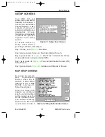
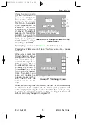
To do this you have to
select for each database
class an ICON or LINE
style, A Topo On Mode
color, a Topo Off Mode
color, an ICON or LINE
MAX zoom level (the
maximum zoom level at
be displayed), a NAME
MAX zoom level (the
maximum zoom level at
which the name label will
be displayed) and a MIN
zoom level (the minimum
zoom level at which both
the icon/line and name
will be displayed. The
default levels are those
shown in the illustrations.
You will notice that there
is a limited choice of icon
styles for some data
classes, this is intentional
in order to keep the
important data (such as
airports) displayed in a
recognizable form. You
will also notice that some
settings have N/A in their
columns and are not adjustable. These are items that have fixed values
and are not user adjustable. A good example of this is that you can not
set up a color for the land in Topo Off Mode because no cartography is
displayed in Topo Off Mode.
Not all data classes shown in the illustrations are available for all geo-
graphic areas. Details of the data classes available on the database
card you have installed are available from Honeywell.
Please think carefully before altering any of the settings on these
screens. You may inadvertently switch off an important data class (such
as obstacles), which could compromise your situation awareness.
Setup Screens
Screen 22B: Line Features Data Class
Setup Screen
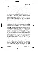
Screen 22C: Airspace Data Class Setup
Screen
KMD 150 PG 5/12/00 12:57 PM Page 91


