2-79
KMD 250 Pilot's Guide
Section 2
FIS Operation
Rev 4 Aug/2007
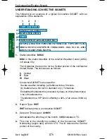
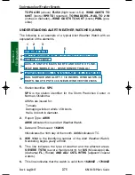
(the 16th at 2300 Zulu to the 17th at 0400 Zulu).
7
.
Coordinates of the watch box area. Draw a line
75 STATUTE
MILES NORTH AND SOUTH OF A LINE..
The endpoints of the line
are
45SSW MOB/MOBILE AL/-30SSE DHN/DOTHAN AL/
(45
miles south-southwest of Mobile, Alabama and 30 miles south-
southeast of Dothan, Alabama). Connect the lines to form the box.
Sometimes it might be defined as
EAST AND WEST OF A LINE..
or
EITHER SIDE OF A LINE..
8
.
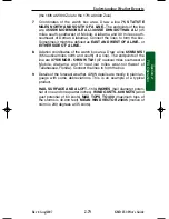
Aviation coordinates of the watch box area. Draw a line
65NM N/S /
(65 nautical miles north and south) of a line). The endpoints of the
line are
37SW MOB - 51WNW TLH/
(37 nautical miles southwest of
Mobile, Alabama and 51 nautical miles west-northwest of
Tallahassee, Florida). Connect the lines to form the box.
9
.
Details of the forecast weather. AWW details are mostly in plain lan-
guage with some abbreviations. This is an example of a typical
product.
HAIL SURFACE AND ALOFT..1 1/4 INCHES
(hail diameter poten-
tial of one and one quarter inches)
WIND GUSTS..60 KNOTS
(wind
gust potential of 60 knots)
MAX TOPS TO 400
(maximum tops of
the storms is 40,000 feet).
MEAN WIND VECTOR 23035
(motion of
storm is 230 degrees at 35 knots).
Understanding Weather Reports
KMD 250 FIS_R4 8/13/07 10:07 AM Page 2-79
Summary of Contents for KMD 250
Page 1: ...B KMD 250 Multi Function Display GPS Pilot s Guide N ...
Page 9: ...R 6 Intentionally left blank ...
Page 19: ...Table of Contents x KMD 250 Pilot s Guide Rev 4 Aug 2007 Intentionally left blank ...
Page 111: ...1 92 Rev 2 Apr 2004 KMD 250 Pilot s Guide Section 1 Basic Operation Map Display Icons ...
Page 112: ...1 93 Rev 2 Apr 2004 KMD 250 Pilot s Guide Section 1 Basic Operation Map Display Icons ...
Page 113: ...1 94 Rev 2 Apr 2004 KMD 250 Pilot s Guide Section 1 Basic Operation Map Display Icons ...
Page 273: ...I 14 Rev 4 Aug 2007 KMD 250 Pilot s Guide Index Index Intentionally left blank ...

