iGage
iG8 User Manual
67
SW
Start Week
ST
Start Time
EW
End Week
ET
End Time
Adjusting Data Stored with an Autonomous Base to an OPUS Position
Often when you first visit a site, you may use ‘Read GPS’ to initialize your base position. The resulting position will be
within 6 feet of the True position for the base point, it will not be exact.
The stored / broadcast base location will have some
Northing
Easting
Height from the True NAD83_2011 Epoch
2010.0 framed coordinate.
Every point that you store will include this positional offset: the vectors between the Base and the Rover points will all
be exact, but the entire job will be shifted around the true positions by the
Northing
Easting
Height. Since this is
GPS and you get a ‘Free Basis of Bearing’ there will be no rotation and no scale factor change, just a NEH translation.
This section details a workflow to adjust your autonomous day’s work to exactly match an OPUS position.
For this example:
A hub and tack have been set at a random point south of a job site
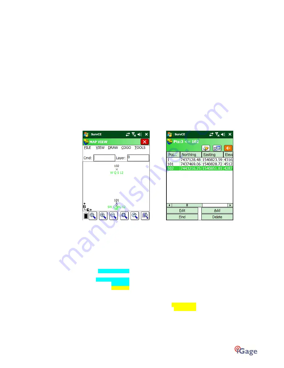
The Base was initialized using ‘Read GPS’ as point ID 1 with description of ‘BB’ as shown in the previous section
Two points: the South West Corner Pt 101 and West Quarter of Section 12 Pt 102 have been stored:
The Static Occupation file from the Base has been downloaded and submitted it to OPUS using the tools and
procedures described in the ‘
Downloading, Processing and Archiving Static Data
’ section found on page 93.
NGS’s OPUS has returned an OPUS report which is shown below:
REF FRAME: NAD_83(2011)(EPOCH:2010.0000) IGS08 (EPOCH:2017.6624)
X: -1802337.501(m) 0.013(m) -1802338.395(m) 0.013(m)
Y: -4492708.224(m) 0.013(m) -4492706.940(m) 0.013(m)
Z: 4141119.504(m) 0.007(m) 4141119.412(m) 0.007(m)
LAT: 40 44 10.27259 0.007(m) 40 44 10.28846 0.007(m)
E LON: 248 8 27.05615 0.007(m) 248 8 27.00042 0.007(m)
W LON: 111 51 32.94385 0.007(m) 111 51 32.99958 0.007(m)
EL HGT: 1304.150(m) 0.017(m) 1303.439(m) 0.017(m)
ORTHO HGT: 1320.877(m) 0.032(m) [NAVD88 (Computed using GEOID12B)]
UTM COORDINATES STATE PLANE COORDINATES
UTM (Zone 12) SPC (4302 UT C)
Northing (Y) [meters] 4509826.918 2266835.529
Easting (X) [meters] 427456.339 469661.993
Convergence [degrees] -0.56068672 -0.23006449
Point Scale 0.99966477 1.00002259
Combined Factor 0.99946031 0.99981805
The method for entering a new point, #2 differs depending on if the projection (the coordinate system) is the State
Plane projection returned in the OPUS solution, or a Localized Coordinate System:


