iGage
iG8 User Manual
97
measurement. The program will automatically convert
to Meters for you.
SLANT HEIGHT in Meters: If you measure a slant
height, enter an ‘S’ after the measurement and the
program will compute the vertical height for you.
SLANT HEIGHT in FEET: If you measure a slant height in
feet, enter ‘SF’ or ‘FS’ after the measurement and the
program will compute the vertical height in Meters for
you.
Note: if you use the ‘PPP Service’ = ‘RTX (CenterPoint)’
the submitted RINEX file spoofs an ‘UNKNOWN EXT
NONE’ and adjusts your actual HI to reflect the generic
antenna L1 offset.
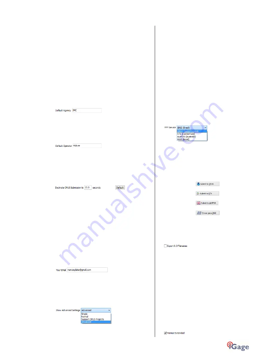
'Default Agency'
Enter your company name here. This value is placed
into every RINEX file that is exported. You can override
this value on a file-by-file basis.
'Default Operator'
Enter the default name of the operator here. This value
is placed into every RINEX file that is exported. You can
override this value on a file-by-file basis.
'Decimate OPUS Submission to ...'
(Hidden when Simple)
When you submit a file to OPUS, it is always decimated
at the NGS server to 15-second epochs (recording
interval = 1 point every 15 seconds.) The default
recording interval for the X9x-OPUS is 5-seconds.
By pre-decimating the RINEX file before upload, it is
reduced to 1/6th the size. This makes the upload
process much faster while having no impact on the
resulting solution.
Observations submitted to RTX are not decimated,
AUSPOS submissions are decimated to 15 seconds.
Observations exported directly to RINEX are not
decimated.
'Your Email'
When you submit a file to OPUS, you need to provide
your Email address so the OPUS processor can return a
solution to you. The email address that you enter here
will be used for all automatic submissions...
'Show Advanced Settings'
This setting determines the complexity of the X9x-
Download program.
Simple: (the Default setting)
Hides archive functions, Minimum File size,
Receiver Model, Antenna Name Decimate setting,
QC function, Export to RINEX button, OPUS-
Projects, the GPS Settings tab and the Log tab.
Normal:
Shows everything except for OPUS-Projects, the
GPS Settings and Log tab.
OPUS-Projects:
Displays the OPUS-Projects checkbox which allows
automatic submission to a NGS registered project.
Advanced:
Displays the GPS Settings and Log tabs.
Typically you will never need to use the 'Advanced'
functions.
‘PPP Service’
(Hidden when Simple)
The Download tool supports several PPP (Precise Point
Positioning) services.
The submit button on the main page tracks this setting
and the upload strategy is adjusted to each available
service.
Additional Information is available on each service on
the web:
OPUS:
http://geodesy.noaa.gov/OPUS/
RTX:
http://trimblertx.com
AUSPOS:
http://www.ga.gov.au/bin/gps.pl
IBGE:
http://www.ibge.gov.br/home/geociencias/geodesia/ppp/default.sht
m
Export 8.3 Filename
(Hidden when Simple)
Normally, the Download program submits files using
filenames like this:
917226_14_072_A0.OBS
The device serial number, the year, the Julian day of
year and the observation number. Some services and
programs prefer names in an 8.3 (xxxxxxxx.xxx) format.
Checking this box results in exported filenames like:
10050720.14O
Where 1005 is the Point ID, 072 is the Julian date, 0 is
the observation number, 14 is the year and O indicates
an observation file.
Format Extended
(Only shown when PPP Service = OPUS)


