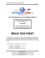


Map and
Nav Info
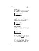
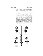
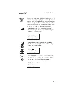
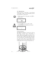
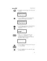
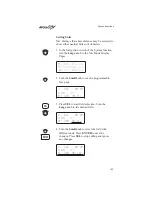
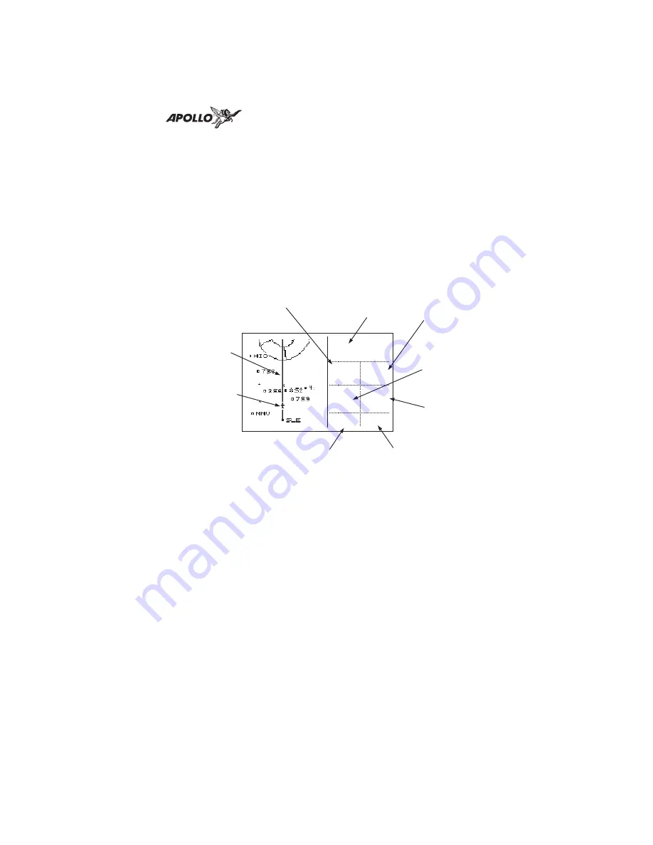
The Map and Nav Info page of the Map function
provides a split screen showing the moving map and
selected navigation information. The navigation
information provided on the right side of the display
includes: the current TO waypoint identifier,
distance and bearing to the TO waypoint from your
current position, ground speed, aircraft current
track, and the map scale.
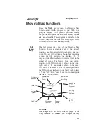
Map Setup
The map setup functions are provided on three
pages. The map setup function allows you to select
the route line, map orientation, map scale for
viewing identifiers, waypoint types that will be
displayed, airspace type, and special use airspaces.
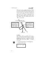
Route Line
A Route Line can be drawn for the current and next
leg of the active route when the selection is turned
on.
TO Waypoint
Identifier
Cross Track Error
Distance & Direction
Bearing to
the TO
Waypoint
Distance to
the TO
Waypoint
Ground
Speed
aPDX
44.2
005
123
006
brg
trk
nm
kt
0.01>
30
Current
Track
Map Scale
t
o
Route Line
Your Present
Position
Moving Map Functions
91