


this data stream and processes the information to
determine which satellites are “visible” to the
receiver’s antenna. With this determination made,
the receiver chooses satellites to calculate a position
fix. Using information transmitted from three or
more satellites, the unit can calculate latitude and
longitude (usually abbreviated Lat/Lon); with four
or more satellites, GPS altitude can also be
calculated.
GPS
System
Accuracy
The GPS allows a high degree of position fix
accuracy. The system can produce a position fix
accurate to within less than one meter under ideal
conditions. Due to concern for national security, the
U.S. Department of Defense introduces constantly
changing errors to the transmitted satellite data to
degrade the accuracy of the system. Called Selective
Availability, this practice limits GPS position fix
accuracy to about 100 meters, although the relative
position of the satellites to one another, their
elevation above the horizon, and other factors can
also affect accuracy of the position fix. Under
optimal conditions, accuracy can improve to within
10 meters. GPS position fix accuracy is not affected
by atmospheric conditions.
GPS altitude is based on a mathematical model of the
shape of the earth, the GWS-84 ellipsoid. Including
intentional degradation, GPS altitude may differ from
barometric altitude by several hundred feet.
Summary
Unlike navigation aids providing a position fix with
data from land-based sources, the Apollo GPS can
provide an accurate position fix over land or sea
anywhere in the world. The unit includes an
extensive database of useful waypoint information
and allows you to create up to 500 “customized”
waypoints of your own. With the power of this
navigation device in the cockpit, you can easily
navigate with unsurpassed accuracy.
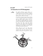
Introduction to GPS Navigation
118