
19
User Manual
NOTE
If the Fish Finder or Radar* is connected, other displaying pages are available
too. See the Fish Finder or Radar* User Manual for more information.
(*)
ONLY
FOR
CM 169CS/169CSI/11CV+/11CVS+
NOTE
See the following table for help to understand the GPS Signal Status page:
COLOR
STATUS
SNR
ELEVATION
GREEN
Tracked - In Use
> 40
<= 45
°
GREEN
Tracked - In Use
> 40
> 45
°
GREEN
Tracked - In Use
< 40
<= 45
°
ORANGE
Tracked - In Use
<= 40
> 45
°
RED
Tracked - Not In Use
- -
- -
GRAY
Not Tracked
- -
- -
CM 11CV+/11CVS+:
If you have selected a Video Input (see Par. 3.11), in the Chart page a window with
the picture captured from the video signal source is shown.
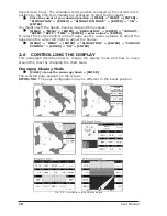
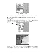
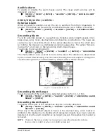
Moving around the Chart and Changing Chart Scale
Use the cursor key to move around the chart. Also use [ZOOM +] and [ZOOM -]
to change the chart scale so that a smaller or larger area is shown on the chart.
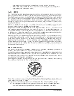
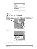
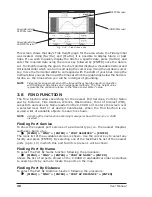
Finding Your Boat Position
The most common use of the chart plotter is to show your ship's current location.
You can home the cursor to the ship using [HOME]. The Home function locks the
cursor to the ship and updates the display as the ship moves.
To release the cursor from the Home Mode, use the cursor key to move the cursor
away from the ship's current position.
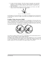
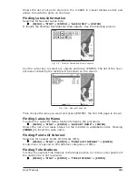
Selecting Look Ahead
In Home mode the Look Ahead function sets up the charts on the navigation
direction (course) in order to display more map details in front of the
vessel’s position.
[HOME] + [MENU] + "SETUP" + [ENTER] + "GENERAL DISPLAY" + [ENTER]
+ "LOOK AHEAD" + [ENTER] + "ON" + [ENTER]
Selecting Map Orientation
To select the orientation of your chart according to:
From the Chart page, [MENU] + "MENU" + [ENTER] + "MAP ORIENTATION"
+ [ENTER]
The available choices are North Up, the map is shown with North upwards, and
Track Up, the map is shown with the ship's current heading upwards. The Resolu-
tion angle can be set:
[MENU] + "SETUP" + [ENTER] + "GENERAL DISPLAY" + [ENTER] + "ORI-
ENT. RESOLUTION" + [ENTER] + use cursor to insert [ENTER]
The Resolution angle, which may be selected in the range [5 – 60] degrees,
defines the maximum variation of the reference angle after which the map changes
its orientation.
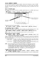
2.7
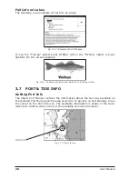
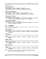
NAVIGATION TO A SINGLE DESTINATION
To place the destination at cursor coordinates and activates navigation to it:
Place the cursor on location to navigate to + [GOTO] + "CURSOR" + [ENTER]
You are now navigating to the destination drawn as a Mark with a circle around it,
labeled "DEST". A straight line is shown on the screen connecting the destination
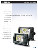
Summary of Contents for Chart Master 169CSI
Page 14: ...16 User Manual...
Page 34: ...36 User Manual...
Page 54: ...56 User Manual...
Page 72: ...74 User Manual...
Page 78: ...80 User Manual...
Page 81: ...83 User Manual INSTALLATION AND REMOVING EXTERNAL WIRING...
Page 84: ...86 User Manual...
Page 86: ...88 User Manual Dimensions...