


54
User Manual
destination is not the external one: (Destination Name, DST and BRG to
Destination, calculate XTE, calculate TTG etc). These values will be displayed all
places where required and they will be used to format NMEA-0183 output data.
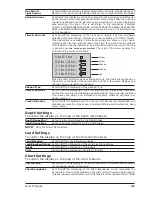
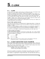
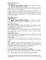
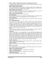
Graphical representation on Map Display
External Destination RED Icon
D
WPT002
N
WPT003
Next Waypoint GREEN Icon
Navigation Leg RED Line
Fig. 5.2 - Graphical Displaying
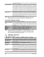
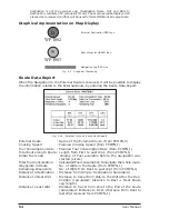
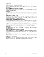
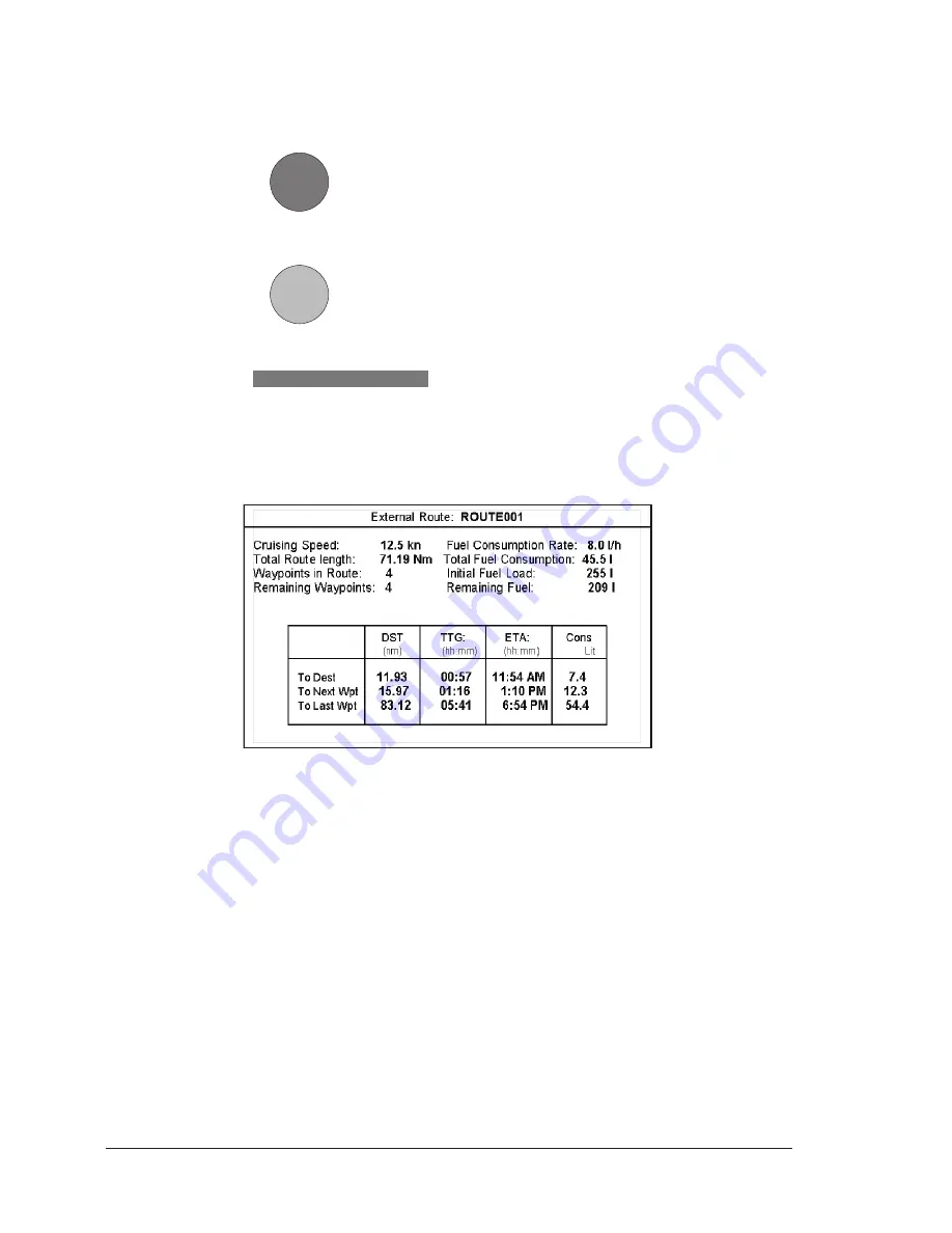
Route Data Report
When the Navigation to the External Route is received, it will be possible to display
the information related to the External Route by entering the Route Data Report.
Fig. 5.2a - External route on Route Data Report
External Route
: Name of the External Route (from PCMPN,0)
Cruising Speed
: Planned Cruising Speed (from PCMPN,1)
Fuel Consumption Rate : Planned Fuel Consumption Rate (from PCMPN,1)
Total Route length Route: Length from First to Last Wpt. (from PCMPN,1)
Initial Fuel Load
: Volume of Fuel available before the navigation was
started (Liters)
Total Fuel Consumption : Calculated Fuel consumption to navigate the whole route.
Waypoints in Route
: No. of Wpts in the Route (from PCMPN,1)
Remaining Waypoints
: No. of Wpts from Dest to Last Wpt (from PCMPN,1)
Distance to Destination : Distance from Ship to Destination (Calculated)
Distance to Next Wpt
: Distance to travel from ship to the Wpt after the Des-
tination (calculated: Distance to Dest + Next Route
Leg length)
Distance to Last Wpt
: Distance to travel from ship to the End of the Route
(Calculated: Distance to Dest +Distance From Dest to
last Wpt received from PCMPN,1)
Summary of Contents for Chart Master 169CSI
Page 14: ...16 User Manual...
Page 34: ...36 User Manual...
Page 54: ...56 User Manual...
Page 72: ...74 User Manual...
Page 78: ...80 User Manual...
Page 81: ...83 User Manual INSTALLATION AND REMOVING EXTERNAL WIRING...
Page 84: ...86 User Manual...
Page 86: ...88 User Manual Dimensions...

![Navig[8]r NAVBIKE-GPS User Manual preview](http://thumbs.mh-extra.com/thumbs/navig-8-r/navbike-gps/navbike-gps_user-manual_3574097-01.webp)