W W W . K A A R T A . C O M
6 2
POINTCLOU D O PERATION S O PTION S
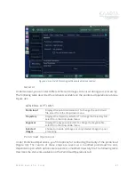
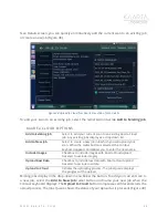
Resolution
Change the resolution (cm) by typing into the appropriate box.
This sets the minimum distance between points in the post-
processed cloud. Post-processing removes points that are closer
than this value to each other to reduce redundant information,
file size, and processing time.
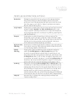
Loop Closure
Checking box includes loop closure in post-processing. Accept the
default or adjust
Gap Size
and
Min. Confidence
values. Loop
closure looks for revisiting of locations in a map and attempts to
merge duplicated versions of a location together by adjusting the
map and trajectory.
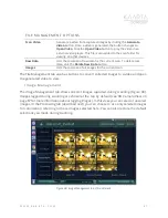
Sharpen
Checking box includes sharpening in post-processing. The
sharpening routine averages out sensor noise and makes edges
sharper and flat surfaces flatter. The Sharpening process also has
the effect of rounding corners and small features.
Use only in
environments where those details are not critical.
Segmentation
Cleaning
Checking box includes segmentation cleaning in post-processing.
This process removes small and poorly defined clusters of points,
such as moving objects and reflections.
Outlier
Cleaning
Checking box cleans outliers from scan. Accept the default or
adjust the
# of Neighbors
and
Std. Deviation
values. This
process removes statistical outliers from the pointcloud. It can
also help to remove moving objects, reflections, and sensor noise.
# of Neighbors
refers to the number of neighboring points used
to determine an “outlier” (between 10 and 100).
Std Deviation
will
determine how many standard deviations away from the mean a
point must be to be removed. Generally, use between 1 and 2.
Leveling
Options for leveling are
None
,
Single Floor
, or
Multi-Floor
. This
tool attempts to level the pointcloud based on detected floors by
leveling large flat surfaces that are spaced apart like floors of an
office building or house. You have the option to run Single Floor
leveling, which levels the entire cloud relative to the floor on
which you started the scan, or Multi-Floor leveling, which attempts
to break apart the scan info floors and level them independently.
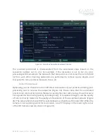
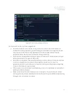
Outputs
Select the box to change the name(s) of the pointcloud and
trajectory output files.


