W W W . K A A R T A . C O M
7 0
CH APTE R 4
S C A N N I N G F O R A D V A N C E D U S E R S
U N D E R S T A N D I N G K E Y P O S E S
Contour has the capability to create detailed and complex maps. Most users do not need
to know all the details underlying the Kaarta Engine. However, a basic understanding of
how Contour uses
Keyposes
to orient itself within the current map, or with respect to a
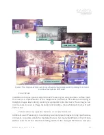
prior map, can be very useful for creating high quality maps. Keyposes refer to a camera
image and scanner location and orientation saved by Contour. By default, Contour saves
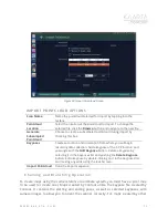
the starting and ending locations as keyposes. You can record additional keyposes by
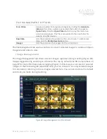
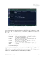
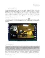
selecting the
Add Keypose
button
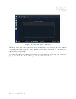
on the top right of the Scanning Menu during an
active scan (see Figure 25). This feature is especially useful for areas that you know you may
want to return to for branching or chaining or a room was not accessible during the original
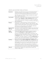
scan. Keyposes provide the capability for three powerful features in Contour.
1.
Adding Data
to any pointcloud regardless of what device collected it.
2.
Chaining
onto the current or previous map
3.
Branching
onto the current or previous map
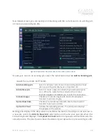
Adding Data
can be performed on imported pointclouds that were generated by any
scanner. Use the Add Keypose options while importing a pointcloud. The imported
pointcloud can then be used as a reference when creating a new Contour scan. You can
add data to an external scan just like you can add data to a Contour-generated pointcloud.
Chaining
and
Branching
provides the ability to create maps that use the same coordinate
system as a reference, which eliminates a map to map registration step. With this capability
you will be able to simply load the previous map and your new map into your favorite third-
party software package and merge them to save it as a single map. Since both use the same
coordinate system they are already registered.
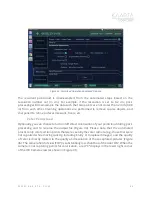
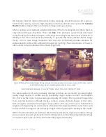
Chaining refers to building a second map referenced to a prior map. This is especially useful
when building a perimeter map to minimize effects of drift and then adding more detail
inside, or immediately adjacent, to the first map. This minimizes drift effects during the
detailed data collection, if the first map has been post-processed to close loops.
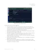
Branching refers to generating a second map after establishing a common coordinate
system with a reference or prior map to eliminate the cloud to cloud registration step when


