W W W . K A A R T A . C O M
6 4
PLAYB ACK PR ESETS
Default
Default preset for playback, applicable to outdoor
scans.
Indoor
Playback preset for improved indoor scans.
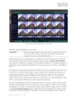
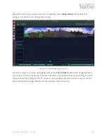
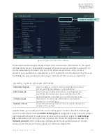
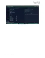
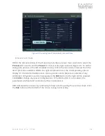
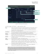
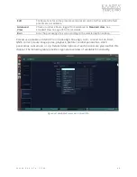
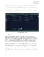
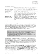
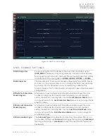
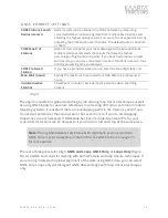
Playback presets include either default (outdoor) or indoor (Figure 43). Once a Playback
preset is chosen, click the
Edit
button to the right of the setting to change the preset
configuration (Figure 44).
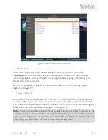
Configuration settings for playback include adjusting the time for playback to start or
changing the duration of playback, using the
Starting Time
and
Duration
settings.
The Duration allows you to play a section of the bag file. If you skip time at the beginning
and set the duration, you can select any part of the bag file for playback.
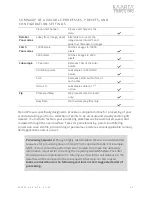
Additional options for improving the quality of your replay include making changes to the
settings for
Ignore Points Beyond
or the travel distance in meters after which the laser
points are not used in matching incoming scan data,
Refinement Resolution
, which
controls the resolution of the point cloud for laser matching and display, the
Matching
Search Range
or the range distance to look for matching features in the lidar data, and
the
Ignore Points Within
, which is the size of the area in meters around the sensor
where points are eliminated.
Minimum Movement
is the minimum distance in meters to
move between two scans to record new data. If 0, every point is logged. If >= 0, log lidar
points every X meters. In general, reducing the number will improve data density but
increase processing and subsequent point cloud size.
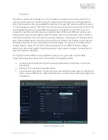
Scan Mode
changes the playback operating modes between mapping and localization.
Mapping is the default mode and is used when you are attempting to replay a new scan
without reference to a prior map. There are situations where you may wish to generate
maps from multiple scans, however. This is done by first creating a baseline map that
Stencil Pro uses as a reference map while collecting more detailed maps, extending maps,
or building maps of more complex environments.
By utilizing the localization Scan Mode, the user can build additional maps using the same
coordinate frame as the first map. This localization process allows the user to increase
overall map accuracy by minimizing drift in the baseline map and can eliminate the
registration step required when merging maps. This feature extends the environments
that can be successfully mapped. As an example, you could build a ground-based map
Note:
Hover over a configuration to show a pop-up tool tip, which gives a brief
definition of the setting.

