W W W . K A A R T A . C O M
6 6
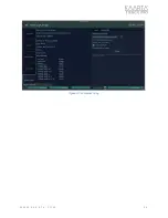
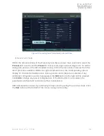
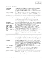
PLAYB ACK SE TTING S
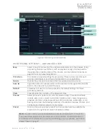
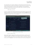
Starting Time
(seconds)
You have the option to skip portions of a scan if you had issues at the
start of the data collection or had an extended pause during
initialization. Enter
Starting Time
location of scan (in seconds) to begin
playback.
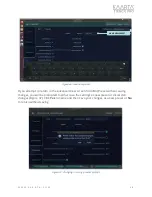
Duration (seconds)
Use the
Duration
to alter the playing time length of your scan. Enter
time for playback to end (in seconds). Entering a 0 will play the entire
file.
Mapping Decay
Distance (meters)
Travel distance in meters after which the laser points are “forgotten”
and not used in matching incoming scan data. For long linear and
straight-line driving or long, large loops, set low (25-50). Increase
number in well constrained small environments with small loops
(conference hall, outside of a smaller building). Setting distance to 0
disables Mapping Decay Distance.
Refinement
Resolution (meters)
Options are 0-3. Resolution of the point cloud in map files. Indoor scans
or tighter spaces would want a higher number (2 or 3), while outdoor or
large open spaces would want a smaller number (0 or 1).
Matching Search
Range (meters)
Range distance to look for matching features in the lidar data. For
indoor environments, increase to 5.0. Default value is 2.0 meters.
Ignore Points Beyond
(meters)
Max range to use for registering scans. Set to a smaller value in dense,
cluttered environments like rain forests. Default is 200.0 meters.
Ignore Points Within
(meters)
The size of the area in meters around the sensor where points are
removed. This eliminates adding points for people following the
scanner or mounting structures in view of the lidar. In tight areas,
reduce the value to 1 or 0.5. Default is 1.5 meters, and 0.75 meters for
indoor.
Minimum Movement
(meters)
Minimum distance in meters to move between two scans to record new
data. If 0, every point is logged. If >= 0, log lidar points every X meters.
In general, reducing the number will improve data density. Increase the
number if you want a coarser point cloud or if you are scanning from a
sedentary with movement occurring around. Default is 0.02 meters.
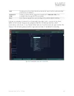
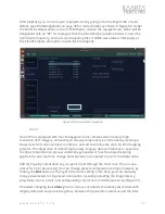
Scan Mode
Scan Mode
changes the playback operating modes between mapping
and localization. Mapping is the default mode and is used when you are
attempting to replay a new scan without reference to a prior map. By
utilizing the localization Scan Mode, the user can build additional maps
using the same coordinate frame as a reference map.
Localization Map
The
Localization Map
is the reference or baseline from which a new
scan is created.
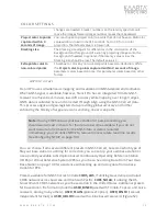
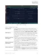
Confidence Plot
During playback, you can elect to show the
Confidence Plot
. The
localization confidence value provides an indication of how the
incoming scans are registered to the apriori map only.
Optimize Raw Data
If you experienced any issues during live scanning, you can choose to
Optimize Raw Data.
This feature verifies and can correct issues with
the original bag file during playback.

