W W W . K A A R T A . C O M
8 0
ALIG N SE TTINGS
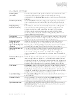
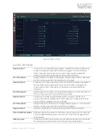
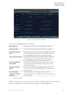
Max HDOP value
Uses the Horizontal Dilution of Precision (HDOP) error estimate to
eliminate GNSS points where the quality is too low or noisy for use in
alignment. Values range from 1 (ideal) to >20 (poor). Default value is 0
(not used).
Max VDOP value
Uses the Vertical Dilution of Precision (VDOP) error estimate to
eliminate GNSS points where the quality is too low or noisy for use in
alignment. Values range from 1 (ideal) to >20 (poor). Default value is 0
(not used).
GPS Horizontal
Weight [0.001-100]
Uses the GPS horizontal weight factor to change the relative priority or
importance of aligning a scan with the GNSS trajectory, as compared to
other factors like loop closure or trajectory continuity. The default value
is 1, which signifies that the GNSS trajectory will have less of an impact
on vertical alignment. Values range from 1 (low impact of GNSS
trajectory on alignment) to 100 (only uses GNSS trajectory for
alignment).
GPS Vertical Weight
[0.001-100]
Uses the GPS vertical weight factor to change the relative priority or
importance of aligning a scan with the GNSS trajectory, as compared to
other factors like loop closure or trajectory continuity. The default value
is 1, which signifies that the GNSS trajectory will have less of an impact
on vertical alignment. Values range from 1 (low impact of GNSS
trajectory on alignment) to 100 (only uses GNSS trajectory for
alignment).
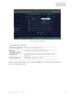
Preferred CRS (EPSG
code)
Sets the preferred coordinate reference system for your dataset, using
the applicable EPSG code. If left blank, the geo-registered map's
coordinates will be referenced to the local UTM zone, based on
latitude/longitude at the start of the scan.
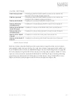
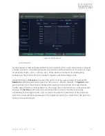
Enable Loop Closure
Check box to enable loop closure techniques for alignment. Uncheck for
GNSS alignment only.
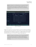
Matching Drift
Distance
Match Distance is the distance between sensor poses of the gap on the
map to be closed. Default is 5.0 meters.
Loop Horizontal
Search Range
Sets the horizontal radius (H) in meters of the two patches to be used
for matching where the two trajectories come close enough to each
other as identified by the match region. Setting the value larger will
increase the post-processing time. Setting it lower will reduce the
search area for matching. Default value is 40.0 meters.
Loop Vertical Search
Range
Sets the vertical height (V) of the two patches to be used for scan
matching. Setting the value larger will increase the post-processing
time. Default is 30.0 meters.
Match Confidence
Threshold
Sets the confidence level below which Align will stop adding scan
frames to the current pose stack and attempt to match the pose stack
back to the registered map. Setting the number as low as 1 will add
significant time to the processing for larger datasets but may be
acceptable when dealing with troublesome spots in the dataset. Default
value is 500 meters.

