W W W . K A A R T A . C O M
7 2
COLOR SE TTING S
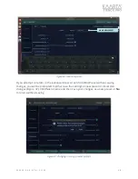
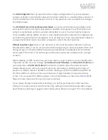
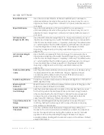
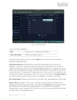
changes are needed. Smaller numbers on the latency spectrum will
move the images forward, larger number moves them backward.
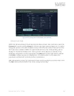
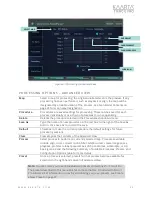
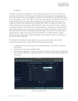
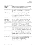
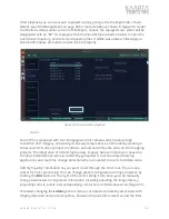
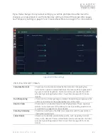
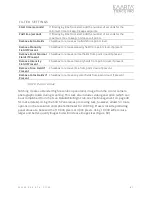
Project color to points
captured within X
seconds of image
You can choose to project color to points that do not have an RGB color
value
within a chosen time
of X seconds. Set to 0.0 for no color
projection. The default value is 2.0 seconds.
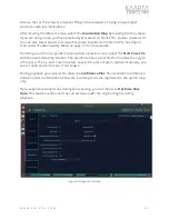
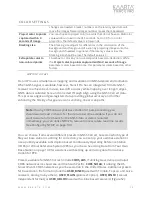
Blocking size
The blocking size adjusts for differences in the colorization of the
background and foreground of a scan by projecting images onto the
background if needed. In general, if the latency value is low, the
blocking size should be low. The default value is 3.
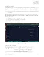
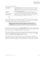
Extrapolate color to
non-colored points
Checkbox to color any non-colored points based on deduction. While
the
Project color to points captured within X seconds of image
parameter colors based on time, this parameter colors based on other
factors.
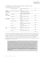
G NSS Correct
Stencil Pro uses simultaneous mapping and localization in GNSS-denied environments.
When GNSS signal is available, however, Stencil Pro has an integrated Trimble GNSS
receiver to achieve best-in-class, low-drift accuracy while mapping over longer ranges.
GNSS data is collected here and corrected through Align using the GNSS Correct data.
This process aligns and geo-registers data, providing global accuracy and further
enhancing the fidelity of large area scans and long, linear scan paths.
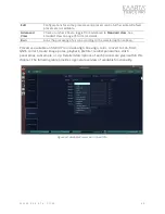
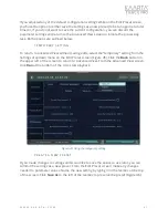
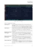
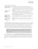
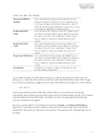
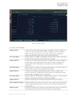
You can choose from several different presets in GNSS Correct, based on which type of
file your base station is utilizing for correction; you can set up your own base station or
use a publicly available subscription based Continuously Operating Reference Station
(CORS) or Virtual Reference System (VRS) as your base. See Using Data From Your Own
Base Station on page 108 for assistance with setting up and using data from a base
station for PPK.
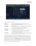
Presets available for GNSS Correct include
CORS_AUS
, if utilizing Geoscience Australia’s
CORS network across Australia and the South Pacific,
CORS_NOAA
, if utilizing the US
Government’s CORS network as your base station in the United States. Additional presets
for base station file format include the
USER_BINEX
(used with Trimble, Topcon, and Leica
receivers, among many others);
USER_PLAIN
(plain text option),
USER_RINEX
(receiver
independent format), or
USER_UBLOX
(used with u-blox based receivers) (Figure 52).
Note:
If using CORS data as your base station for post-processing, you
should wait at least 24 hours for the data to become available. If you do not
want to wait a full 24 hours for the GNSS data or data is required
immediately, you can utilize NTRIP to receive more accurate real-time results
(see Configuring NTRIP on page 101).

