Chapter 6 Map operation
MDC-7000/7900 Series
0093169010-10
6-12
6.8
AREA
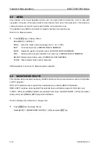
Area function is for visual navigation where user can input points connected by a line to help with
navigation. There are 10 memory blocks for area that can hold up to 100 points each. This function is
valid with a minimum input of 3 points which will be connected with a line.
It is possible to use AREA to set alarm for targets entering or leaving the area.
Refer to 3.2 Map area alarm.
1
Press MENU key to display
“Menu”.
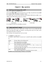
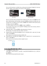
Select [MAP] => [AREA] =>
AREA: Select the block number to display. (ALL, 1 to 10, OFF)
EDIT:
To create new area. (CURSOR, BLOCK NUMBER)
MOVE: Revise the position of points in area. (CURSOR, BLOCK NUMBER)
ADD:
Add a point to any given position in an area line. (CURSOR, BLOCK NUMBER)
DELETE: Delete a point data in area. (CURSOR, BLOCK NUMBER)
CLEAR: Clear selected block number area data
AREA operation is same as 3.2 Map area alarm operation.
6.9
MONITORED ROUTE
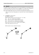
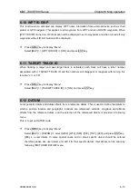
This function when activated can display ROUTE information from external device such as chart plotter
or GPS navigator.
RTE + WPL sentences are required from external device to display ROUTE information.
RMB or BWC sentence when inputted from external device will display waypoint information only.
If [RTE + WPL] and [RMB] or [BWC] are inputted in the radar, the ROUTE [RTE + WPL] information
takes priority over [RMB] or [BWC] waypoint information.
Route is displayed by dotted line in orange color.
1
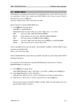
Press MENU key to display
“Menu”.
Select [MAP] => [MONITORED ROUTE] => [ON], and press ENT key.
Summary of Contents for MDC-7010
Page 1: ......
Page 2: ......
Page 144: ... This page intentionally left blank ...
Page 170: ... This page intentionally left blank ...
Page 176: ... This page intentionally left blank ...
Page 192: ... This page intentionally left blank ...
Page 234: ......


