Section 7
Columbia 400 (LC41-550FG)
Description of the Airplane and Systems
Initial Issue of Manual: November 10, 2004
RC050002
Latest Revision Level/Date: A/12-01-2004
7-97
Trip Page (with Datalink Weather)
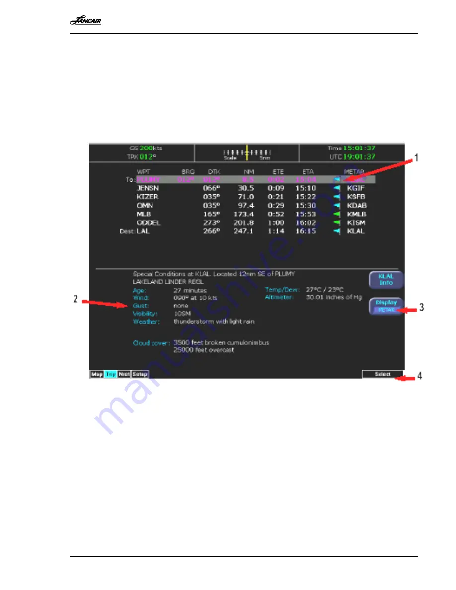
The MFD Trip page also displays weather information from the broadcast weather datalink. Each
waypoint on the current active flight plan is associated with a METAR reporting point. For non-
airport waypoints, the nearest METAR is used. The general conditions are reported with the
same METAR flags as used on the Map page, here shown in a column for each waypoint. The
full translated text METAR for the currently highlighted waypoint is shown in the lower portion
of the Trip page. If legs on the flightplan exceed 100 miles in length, the MFD will select
"intermediate waypoints" in between the waypoints of the leg, in order to provide greater
situational awareness of the weather conditions along the route.
Figure 7 - 33
Figure 7 - 33 shows the following items:
1.
METAR symbols –
Using the same METAR condition symbols as the Map page, a METAR
report is shown for each flightplan waypoint.
2.
METAR text –
the METAR is translated into plain English and presented for the currently-
selected waypoint. If the METAR report is for an airport near the waypoint, the distance and
direction from the waypoint is shown.
3.
Display button –
controls the display in the bottom half of the Trip page. Pressing this
button alternates between METAR, Legend, and Status. (see below)
4.
Select knob –
use the right Select knob to move the highlight up and down the waypoint list
to view the text METAR for the waypoints on the route.


