94
User Manual
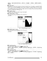
Depth Window
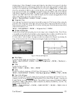
Turns On/Off the display of Depth Window on the screen. The default setting is Off.
'MENU' +
"BASIC SETTINGS" + 'ENTER' + "DEPTH WINDOW" + 'ENTER'
DGPS = Differential GPS
Provides even greater positioning accuracy than standard GPS.
Dynamic Nav Aids
This function allows settings blinking lights on Nav-Aids. The blink period and color of each Nav-aid
is read from the Nav-Aid attributes available on the data cartridge. When the ship is inside the Nav-Aid
nominal range, the light of the Nav-Aid will start blinking.
'MENU' +
"MAP SETTINGS" +'ENTER' + "Dynamic Nav Aids" + 'ENTER'
Diffusers
Turns Off (the object is not visible independently of the selected “Underwater Object Depth Value)/
Icon (the object icon is visible without tags, in the range selected from “Underwater Object Depth
Value” option
)
/Icon+Depth (the object icon and tag is visible, in the range selected from “Underwater
Object Depth Value” option) the displaying of Obstructions. The default setting is Icon.
'MENU' + "MAP SETTINGS" +'ENTER' + "Other Map Configurations" + 'ENTER' + "Diffusers" +
'ENTER'
Display Mode
To simplify the customization of the chart display, the map settings are now re-organized in modes
allowing the user to choose the preferred setting. Pre-programmed settings are user selectable from
Full, Medium, Low, Radar, Tides, Custom. The default setting is Custom.
'MENU' + "MAP SETTINGS" +'ENTER' + "Other Map Configurations" + 'ENTER' + "Display Mode"
+ 'ENTER'
Distance (Track)
When the tracking function is On and the type of track storing is Distance, you can store a fix when the
distance from its last stored position is greater than a defined distance. Choose in the range 0.01, 0.05, 0.1,
0.5, 1.0, 2.0, 5.0, 10.0 Nm (the distance unit is selected by the user). The default setting is 0.01 Nm.
'MENU' + "ADVANCED SETTINGS" + 'ENTER' + "TRACK" + 'ENTER' + "DISTANCE" + 'ENTER'
Distance (Unit)
Sets the distance unit among Nm = nautical miles, Sm = status miles e Km = kilometers. The default
setting is Nm.
'MENU' +
"BASIC SETTINGS" + 'ENTER' + "DISTANCE" + 'ENTER'
DTG = Distance To Go
The actual distance to reach the Target.
DSC
DSC
(Digital Selective Calling)
is a method of establishing a VHF radio call; it is used to announce
urgent maritime safety information broadcasts. This system allows mariners to instantly send Distress
Call or/and Position Request to the other vessels equipped with a DSC transceiver within range of the
transmission.
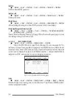
'MENU' +
"DSC" + 'ENTER'
EBL = Electronic Bearing Line
Dotted line with direction selectable by the user (see Par. 4.3).
Select Advanced Mode + 'ENTER' + "EBL & VRM" + 'ENTER'
Echosounder
AVAILABLE ONLY IF THE CHARTPLOTTER IS CONNECTED TO THE
VOICE NAVIGATION SYSTEM
Enables (On) or disables (Off) the Echosounder C-Voice mode. If it is On, the Depth message is spo-
ken. The message is spoken if a valid depth data is received by the chart plotter or if it is in Simulation
mode. The default setting is Off.
Summary of Contents for MAGNUM PLUS
Page 8: ...10 User Manual ...
Page 12: ...14 User Manual ...
Page 22: ...24 User Manual ...
Page 46: ...48 User Manual ...

