64
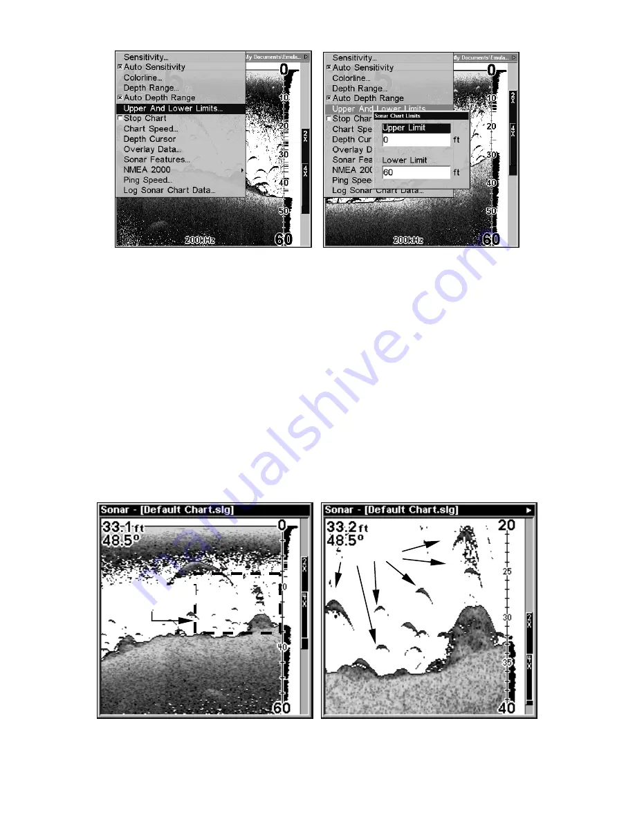
Sonar Page Menu with Upper and Lower Limits command selected
(left). Sonar Chart Limits menu with Upper Limit selected (right).
To change the upper and lower limits:
1. From the Sonar Page, press
MENU
|
↓
to
U
PPER
A
ND
L
OWER
L
IMITS
|
ENT
.
The Sonar Chart Limits menu appears, with Upper Limit selected.
2. To set the upper limit, press
ENT
. Press
↑
↓
to change the first num-
ber, then press
→
to move the cursor to the next number and repeat
until the depth is correct, then press
EXIT
.
3. To set the lower limit, press
↓
to
L
OWER
L
IMIT
|
ENT
. Press
↑
↓
to change
the first number, then press
→
to move the cursor to the next number
and repeat until the depth is correct, then press
EXIT
repeatedly.
To turn off upper and lower limits:
From the Sonar Page, press
MENU
|
↓
to
A
UTO
D
EPTH
R
ANGE
|
ENT
|
EXIT
.
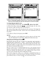
Display in auto depth range mode (left). Display zoomed with Upper
and Lower Limits focused on water column from 20 to 40 feet (right).
Area "zoomed"
Fish arches
Summary of Contents for LMS-334c iGPS
Page 62: ...54 Notes ...
Page 98: ...90 Notes ...
Page 102: ...94 Notes ...
Page 134: ...126 Notes ...
Page 148: ...140 Notes ...
Page 182: ...174 Notes ...
Page 197: ...189 Notes ...


