Operating Modes
Version 6.03, May 2017
Page 108 of 192
5.2.3
Satellite Sky View
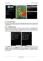
Information about tracked satellites is given on this page. If no satellite information is
available a message
“No satellite info”
is displayed.
Green satellites are satellites currently being used for position determination. Three
concentric circles represent satellite elevation (0, 30, 60 degrees above horizon). If a
satellite is in the centre of the circles it is directly overhead.
When you are experiencing bad satellite reception, check this page. If the satellites are
always red in a particular place, you should consider moving the GPS antenna to another
position. If you press the
MARK
button a new waypoint will be created.
At some instruments that page is not visible
5.2.4
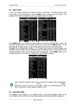
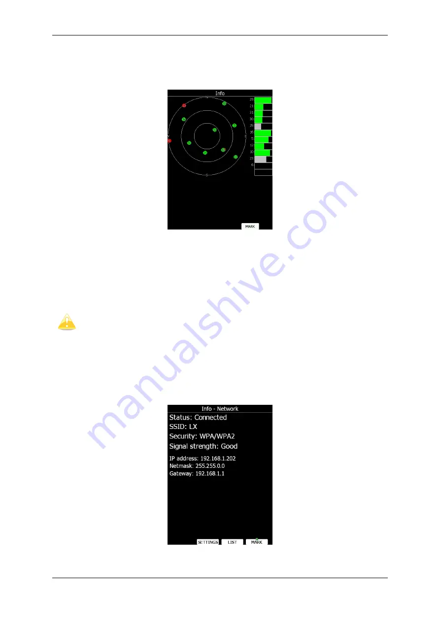
Network status
Network status information is given on this page. Press
LIST
button to list available
networks. Press
SETTINGS
button to set up network properties. See also chapter


