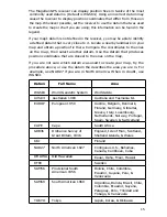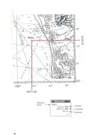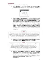
The Magellan GPS receiver can display position fixes in twelve of the most
commonly used datums. (Default is WGS84.) Using an incorrect datum may
cause the receiver to display position coordinates that differ from those on
the map. Whenever possible, set the receiver to use the datum that was used
to create the map or chart you are using; this information can be found in the
legend.
lf your map's datum is not defined in the receiver, you may be able to identify
a defined datum that is very close to it. Locate a nearby landmark on your
map and obtain a position fix there. Compare the coordinates to the ones
on the map, then select another datum. Use the datum that produces
position coordinates that are closest to the ones on the map.
lf you are not sure which datum was used to create your map, try the
procedure above, or use the datum the describes the area you are in. For
example, use NAD27 if you are in North America. When in doubt, use
WGS84.
Datum
Full Name
Area
WGS84
World Geodetic System
Worldwide
AUS84
Australian 1984
Australia and Tasmania Isl.
EUROP
European 1950
Austria, Belgium, Denmark,
Finland, Germany, Gibraltar,
Greece, Italy, Luxembourg,
Netherlands, Norway, Portugal,
Spain, Sweden, & Switzerland
CAPE
Cape
South Africa
GRB36
Ordnance Survey of
Great Britain, 1936
England, Isle of Man, Scotland,
Shetland Islands, & Wales
KKJ
Finland
NAD27
North American 1927
Contiguous U.S., Bahamas,
Canada, Caribbean, Cuba
OHAWA
Old Hawaiian
Kauai, Oahu, Maui, Hawaii
RT90
Sweden
SAM56
Provisional South
American 1956
Bolivia, Chile, Colombia,
Ecuador, Guyana, Peru, &
Venezuela
SAM69
South American 1969
Argentina, Bolivia, Brazil, Chile,
Colombia, Ecuador, Guyana,
Paraguay, Peru, Trinidad and
Tobago, & Venezuela
TOKYO
Tokyo
Japan, Korea, & Okinawa
15
Summary of Contents for Trailblazer
Page 1: ...Magellan GPS Satellite Navigator Reference Guide...
Page 24: ...20...
Page 31: ...27...
Page 41: ...960 Overland Court San Dimas CA 91773 909 394 5000 22 60005 012...


