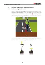
Line and probe location in “Ferrolux” mode
62
To keep track of the signal level, current and depth measurements during line tracing, a
measurement point should be saved (see page 49) at short intervals. If the indicator unit
is coupled with a GPS receiver (see page 43), the GPS coordinates of the individual
measurement points are also stored. A map display of the path of the line can be
created in the office later using this data.
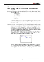
Branches in the path of the line can be recognised from the fact that the current is
divided between both lines. The ratio depends on the length of the respective branches
and the earthing conditions.
750 mA
250 mA
500 mA
Summary of Contents for digiPHONE+2
Page 2: ...2 ...


